Measuring the size of the Earth,1671
Bildnummer 11595224
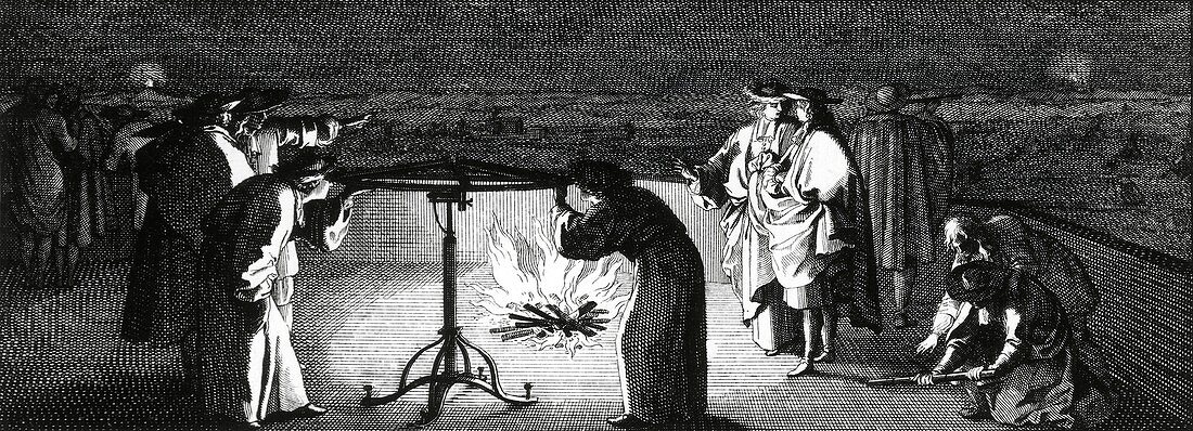
| Measuring the size of the Earth. Surveyors measuring angles for triangulation at night,during the 1669-1670 survey to determine the size of the Earth. The other corners of the triangulation triangle are marked by beacon fires (top left and top right). This survey was carried out by the French astronomer Jean Picard (1620-1682) using 13 triangulation triangles from Paris to Sourdon,along the Paris Meridian. By using telescopes and micrometers,the result was the most accurate of the time. This artwork,by French illustrator Sebastien Leclerc (1637-1714),is a frontispiece vignette from Picard's book Mesure de la Terre (1671) | |
| Lizenzart: | Lizenzpflichtig |
| Credit: | Science Photo Library / Royal Astronomical Society |
| Bildgröße: | 7120 px × 2575 px |
| Modell-Rechte: | nicht erforderlich |
| Eigentums-Rechte: | nicht erforderlich |
| Restrictions: | - |
Preise für dieses Bild ab 15 €
Universitäten & Organisationen
(Informationsmaterial Digital, Informationsmaterial Print, Lehrmaterial Digital etc.)
ab 15 €
Redaktionell
(Bücher, Bücher: Sach- und Fachliteratur, Digitale Medien (redaktionell) etc.)
ab 30 €
Werbung
(Anzeigen, Aussenwerbung, Digitale Medien, Fernsehwerbung, Karten, Werbemittel, Zeitschriften etc.)
ab 55 €
Handelsprodukte
(bedruckte Textilie, Kalender, Postkarte, Grußkarte, Verpackung etc.)
ab 75 €
Pauschalpreise
Rechtepakete für die unbeschränkte Bildnutzung in Print oder Online
ab 495 €
Keywords
- 1600er Jahre,
- 17. Jahrhundert,
- Astronom,
- Astronomie,
- astronomisch,
- Dreieck,
- Dreieckig,
- Einfarbig,
- Entfernung,
- Entfernungen,
- Erwachsene,
- Europa,
- europäisch,
- Fernrohr,
- Frankreich,
- Französisch,
- geografisch,
- Geographie,
- Geschichte,
- Geschichte der Wissenschaft,
- historisch,
- Illustration,
- Instrument,
- Instrumente,
- kaukasisch,
- Kunstwerk,
- Mann,
- Männer,
- Männlich,
- Mensch,
- Menschen,
- Nacht,
- Person,
- Schwarz und weiß,
- weiß,
- Wissenschaftler