Australian bushfires,satellite image
Bildnummer 11592946
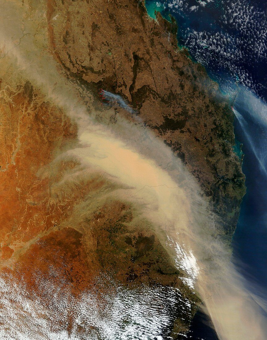
| Australian bushfires,satellite image. North is at top. This image,several hundred kilometres across,shows part of Australia's eastern coast,with Brisbane at far centre right. A large plume of dust (light brown) covers much of the central and lower right area,showing the prevailing winds blowing to the south-east. Fires (red,upper right and upper left) have smoke (grey) trailing from them. Also shown are clouds (white,bottom) and the state boundary line (across centre) between Queensland (top) and New South Wales (bottom). Image obtained at 00:35 UTC (10:35 local time) on 26 September 2009,by NASA's Terra satellite | |
| Lizenzart: | Lizenzpflichtig |
| Credit: | Science Photo Library / NASA |
| Bildgröße: | 3720 px × 4735 px |
| Modell-Rechte: | nicht erforderlich |
| Eigentums-Rechte: | nicht erforderlich |
| Restrictions: | - |
Preise für dieses Bild ab 15 €
Universitäten & Organisationen
(Informationsmaterial Digital, Informationsmaterial Print, Lehrmaterial Digital etc.)
ab 15 €
Redaktionell
(Bücher, Bücher: Sach- und Fachliteratur, Digitale Medien (redaktionell) etc.)
ab 30 €
Werbung
(Anzeigen, Aussenwerbung, Digitale Medien, Fernsehwerbung, Karten, Werbemittel, Zeitschriften etc.)
ab 55 €
Handelsprodukte
(bedruckte Textilie, Kalender, Postkarte, Grußkarte, Verpackung etc.)
ab 75 €
Pauschalpreise
Rechtepakete für die unbeschränkte Bildnutzung in Print oder Online
ab 495 €
Keywords
- 21. Jahrhundert,
- Australien,
- australisch,
- blasend,
- Brisbane,
- Feuer,
- geografisch,
- Geographie,
- Meteorologie,
- meteorologisch,
- Natur,
- New South Wales,
- Plume,
- Queensland,
- Rauch,
- Sand,
- Sandsturm,
- Satellit,
- Satellitenbild,
- Schrubben,
- September,
- Staub,
- Terra,
- trocken,
- Verbrennung,
- Waldbrände,
- Weltall,
- Wetter,
- Wüste