Ground Zero,Manhattan,LIDAR image
Bildnummer 11592667
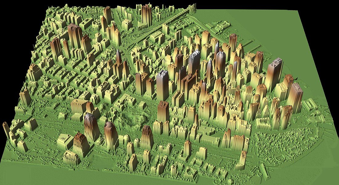
| Ground Zero. Three dimensional LIDAR (light detection and ranging) image of Lower Manhattan,New York City,USA,showing Ground Zero (lower centre),the former World Trade Centre site. This map was used to help the recovery and clean-up efforts after the terrorist attack on the twin towers of the World Trade Centre on 11th September 2001. Hijacked passenger planes were flown into the towers,causing their collapse and killing thousands. Data obtained on 27th September 2001 | |
| Lizenzart: | Lizenzpflichtig |
| Credit: | Science Photo Library / US Army / NOAA / JPSD |
| Bildgröße: | 4000 px × 2185 px |
| Modell-Rechte: | nicht erforderlich |
| Eigentums-Rechte: | nicht erforderlich |
| Restrictions: |
|
Preise für dieses Bild ab 15 €
Universitäten & Organisationen
(Informationsmaterial Digital, Informationsmaterial Print, Lehrmaterial Digital etc.)
ab 15 €
Redaktionell
(Bücher, Bücher: Sach- und Fachliteratur, Digitale Medien (redaktionell) etc.)
ab 30 €
Werbung
(Anzeigen, Aussenwerbung, Digitale Medien, Fernsehwerbung, Karten, Werbemittel, Zeitschriften etc.)
ab 55 €
Handelsprodukte
(bedruckte Textilie, Kalender, Postkarte, Grußkarte, Verpackung etc.)
ab 75 €
Pauschalpreise
Rechtepakete für die unbeschränkte Bildnutzung in Print oder Online
ab 495 €
Keywords
- 21. Jahrhundert,
- 3-d,
- 3D,
- Amerikanisch,
- Antenne,
- Dreidimensional,
- Folge,
- Gebäude,
- Ground Zero,
- Innenstadt,
- Lower Manhattan,
- Manhattan,
- New York City,
- Nordamerika,
- Physik,
- physisch,
- Stadt,
- städtisch,
- Technologie,
- technologisch,
- Terrorismus,
- USA,
- Vereinigte Staaten,
- Zerstörung,
- zestört,
- Zwillingstürme