Land survey from 1722
Bildnummer 11592323
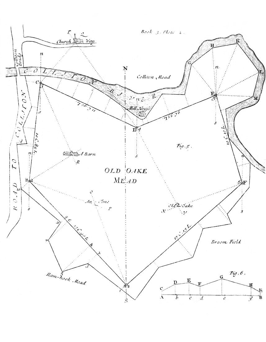
| Land survey. Diagram of the land survey of an irregular field,from the 1722 fifth edition of The Compleat Surveyor by the English land surveyor William Leybourn (1626-1716). This work was originally published in 1653. It described the process of surveying,and became a standard work used by property surveyors when drawing up maps of private estates. Here,the land is named as 'Old Oake Mead',and the lines show the landmarks used to construct this map of the property. The fifth edition was printed in London | |
| Lizenzart: | Lizenzpflichtig |
| Credit: | Science Photo Library / Royal Astronomical Society |
| Bildgröße: | 4235 px × 5433 px |
| Modell-Rechte: | nicht erforderlich |
| Eigentums-Rechte: | nicht erforderlich |
| Restrictions: | - |
Preise für dieses Bild ab 15 €
Universitäten & Organisationen
(Informationsmaterial Digital, Informationsmaterial Print, Lehrmaterial Digital etc.)
ab 15 €
Redaktionell
(Bücher, Bücher: Sach- und Fachliteratur, Digitale Medien (redaktionell) etc.)
ab 30 €
Werbung
(Anzeigen, Aussenwerbung, Digitale Medien, Fernsehwerbung, Karten, Werbemittel, Zeitschriften etc.)
ab 55 €
Handelsprodukte
(bedruckte Textilie, Kalender, Postkarte, Grußkarte, Verpackung etc.)
ab 75 €
Pauschalpreise
Rechtepakete für die unbeschränkte Bildnutzung in Print oder Online
ab 495 €
Keywords
- 1600er Jahre,
- 17. Jahrhundert,
- 1700er Jahre,
- 18. Jahrhundert,
- Bauernhof,
- Blatt,
- Buch,
- Diagramm,
- Einfarbig,
- Englisch,
- europäisch,
- Feld,
- Felder,
- geografisch,
- Geographie,
- Geschichte,
- Grenze,
- Grenzen,
- Herrenhaus,
- historisch,
- Illustration,
- Karte,
- Kirche,
- Kunstwerk,
- Schwarz und weiß,
- Straße,
- Technologie,
- technologisch,
- Wahrzeichen,
- William Leybourn