San Francisco earthquake risk forecast
Bildnummer 11592218
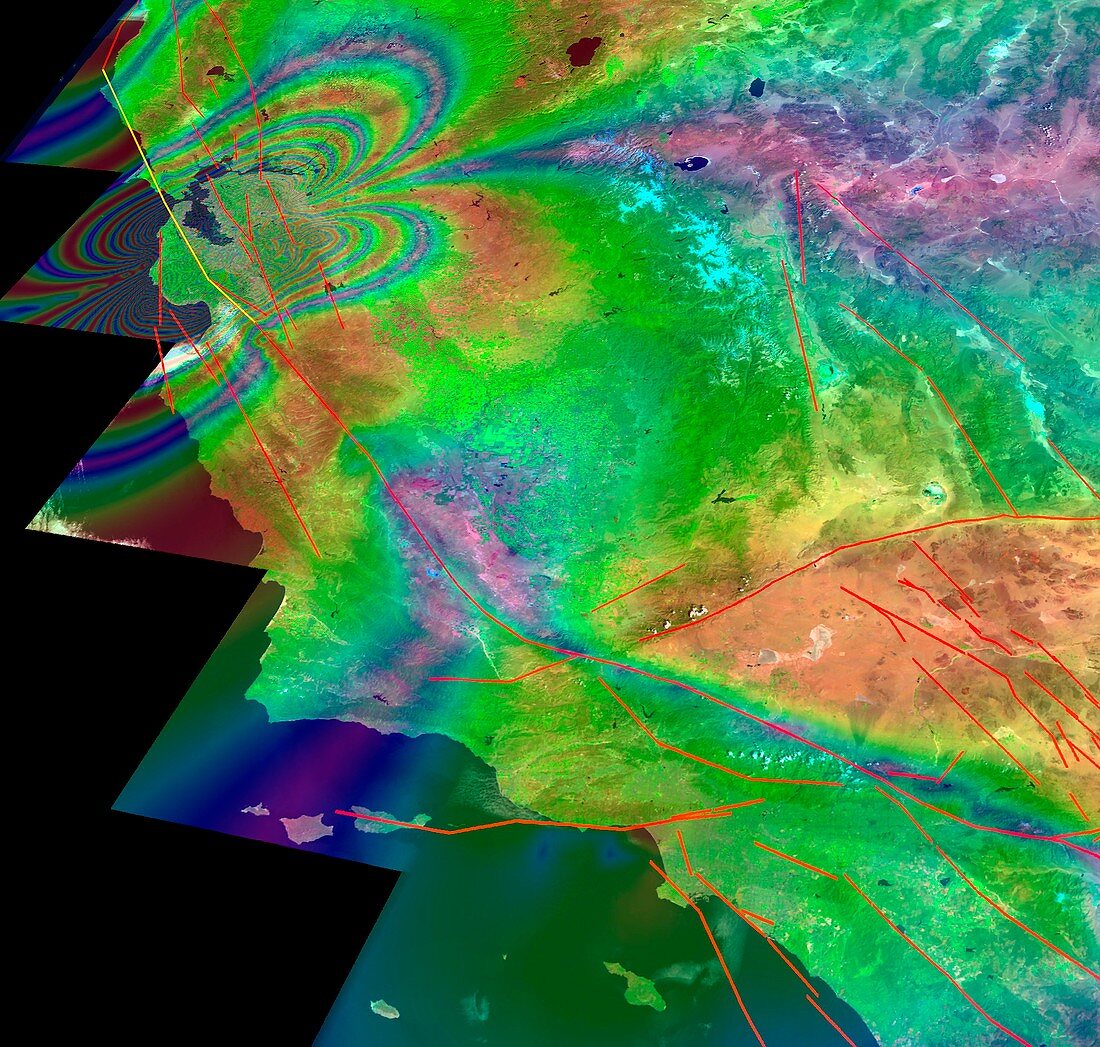
| San Francisco earthquake risk forecast. Satellite image of California,USA,showing earthquake faults (red lines) and synthetic aperture radar patterns of seismic deformations resulting from a model earthquake on the San Andreas fault (yellow line). The changes in colour represent the displacement of the ground due to the earthquake. The model has estimated that there is a 25 per cent chance of an earthquake measuring magnitude 7 or above in the next 20 years along the San Andreas fault. SAR images are created by transmitting successive pulses of radio waves to "illuminate" a target scene,and the echo of each pulse is received and recorded | |
| Lizenzart: | Lizenzpflichtig |
| Credit: | Science Photo Library / NASA / UCDAVIS / JPL |
| Bildgröße: | 2577 px × 2452 px |
| Modell-Rechte: | nicht erforderlich |
| Eigentums-Rechte: | nicht erforderlich |
| Restrictions: | - |
Preise für dieses Bild ab 15 €
Universitäten & Organisationen
(Informationsmaterial Digital, Informationsmaterial Print, Lehrmaterial Digital etc.)
ab 15 €
Redaktionell
(Bücher, Bücher: Sach- und Fachliteratur, Digitale Medien (redaktionell) etc.)
ab 30 €
Werbung
(Anzeigen, Aussenwerbung, Digitale Medien, Fernsehwerbung, Karten, Werbemittel, Zeitschriften etc.)
ab 55 €
Handelsprodukte
(bedruckte Textilie, Kalender, Postkarte, Grußkarte, Verpackung etc.)
ab 75 €
Pauschalpreise
Rechtepakete für die unbeschränkte Bildnutzung in Print oder Online
ab 495 €