Sand and gravel quarries,satellite image
Bildnummer 11592070
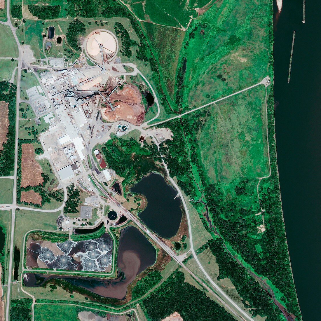
| Sand and gravel quarries,GeoEye-1 satellite image. North is at top. This site is just south of Morrilton,Arkansas,USA,on the Arkansas River,which is at far right. Arkansas Highway 113 is at far left. A sand quarry (brown) is at upper left,with conveyors belts taking sand to processing facilities. River water used on this site is channelled to evaporation pools at lower left. A railway track leads from the site towards lower right. Image data obtained on 23 August 2009. The US-operated GeoEye-1 satellite was launched in September 2008,and orbits at a height of 680 kilometres. It is the world's highest resolution commercial Earth-imaging satellite | |
| Lizenzart: | Lizenzpflichtig |
| Credit: | Science Photo Library / Geoeye |
| Bildgröße: | 3000 px × 3000 px |
| Modell-Rechte: | nicht erforderlich |
| Eigentums-Rechte: | nicht erforderlich |
| Restrictions: | - |
Preise für dieses Bild ab 15 €
Universitäten & Organisationen
(Informationsmaterial Digital, Informationsmaterial Print, Lehrmaterial Digital etc.)
ab 15 €
Redaktionell
(Bücher, Bücher: Sach- und Fachliteratur, Digitale Medien (redaktionell) etc.)
ab 30 €
Werbung
(Anzeigen, Aussenwerbung, Digitale Medien, Fernsehwerbung, Karten, Werbemittel, Zeitschriften etc.)
ab 55 €
Handelsprodukte
(bedruckte Textilie, Kalender, Postkarte, Grußkarte, Verpackung etc.)
ab 75 €
Pauschalpreise
Rechtepakete für die unbeschränkte Bildnutzung in Print oder Online
ab 495 €
Keywords
- 21. Jahrhundert,
- Amerikanisch,
- Arkansas,
- Bergbau,
- Eisenbahn,
- Fabrik,
- Fluss,
- Förderband,
- Gebäude,
- GeoEye-1,
- geografisch,
- Geographie,
- Industrie,
- Kies,
- ländlich,
- Nordamerika,
- nordamerikanisch,
- Pools,
- Sand,
- Satellit,
- Satellitenbild,
- Schwimmbad,
- Steinbruch,
- Straße,
- Technologie,
- technologisch,
- USA,
- Vereinigte Staaten,
- Weltall