Hoover Dam,satellite image
Bildnummer 11592064
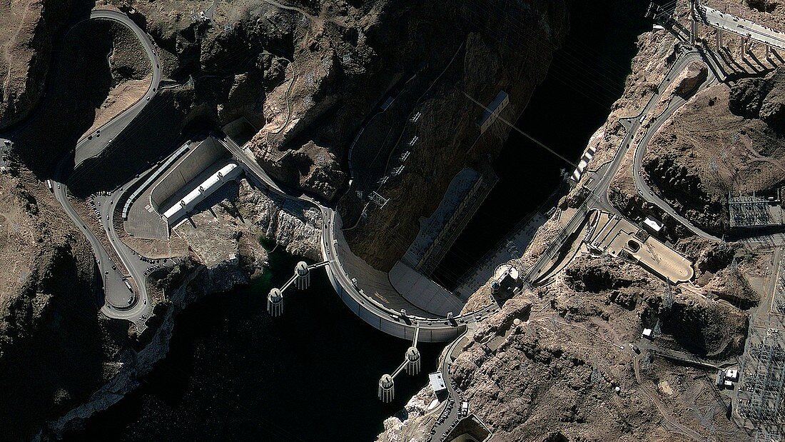
| Hoover Dam,GeoEye satellite image. North is at bottom. This dam is located on the Colorado River,USA,with Lake Mead behind it. Below the 221-metre-high dam,the river flows through Black Canyon. The Hoover Dam was built between 1931 and 1936. Large amounts of hydroelectric power are generated at this dam,and pylons and power station equipment are at right. Behind the dam are the four penstock towers,used to control the water flow. The road crossing the dam is US Route 93. GeoEye is a US-based company that operates a range of satellites that provide the world's highest resolution commercial satellite images | |
| Lizenzart: | Lizenzpflichtig |
| Credit: | Science Photo Library / Geoeye |
| Bildgröße: | 3969 px × 2232 px |
| Modell-Rechte: | nicht erforderlich |
| Eigentums-Rechte: | nicht erforderlich |
| Restrictions: | - |
Preise für dieses Bild ab 15 €
Universitäten & Organisationen
(Informationsmaterial Digital, Informationsmaterial Print, Lehrmaterial Digital etc.)
ab 15 €
Redaktionell
(Bücher, Bücher: Sach- und Fachliteratur, Digitale Medien (redaktionell) etc.)
ab 30 €
Werbung
(Anzeigen, Aussenwerbung, Digitale Medien, Fernsehwerbung, Karten, Werbemittel, Zeitschriften etc.)
ab 55 €
Handelsprodukte
(bedruckte Textilie, Kalender, Postkarte, Grußkarte, Verpackung etc.)
ab 75 €
Pauschalpreise
Rechtepakete für die unbeschränkte Bildnutzung in Print oder Online
ab 495 €
Keywords
- 21. Jahrhundert,
- Amerikanisch,
- Autobahn,
- Colorado,
- Colorado River,
- Damm,
- Elektrisch,
- Elektrizität,
- Energie,
- erneuerbar,
- Fluss,
- Gebäude,
- geografisch,
- Geographie,
- Industrie,
- Industriell,
- Ingenieurwesen,
- Kraftwerk,
- Leistung,
- Nachhaltig,
- Nordamerika,
- nordamerikanisch,
- Satellit,
- Satellitenbild,
- Schlucht,
- Straße,
- Technologie,
- technologisch,
- Türme,
- Umweltwissenschaften,
- USA,
- Vereinigte Staaten,
- Weltall