Pyramids of Giza,Egypt,satellite image
Bildnummer 11592063
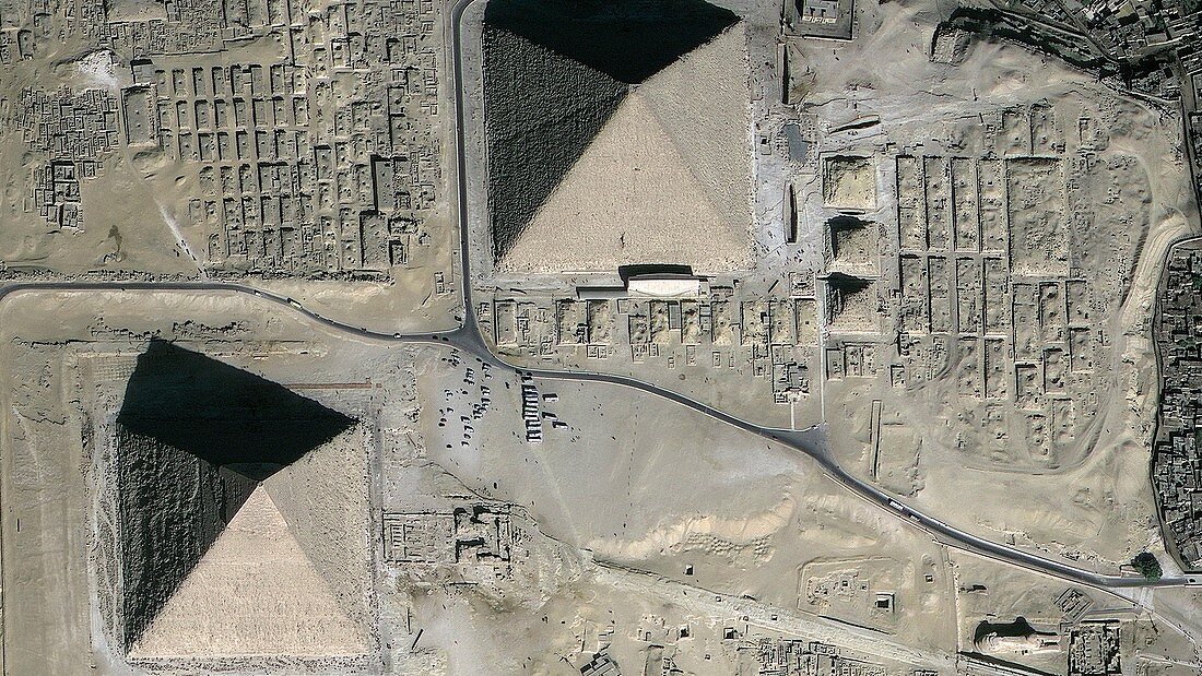
| Pyramids of Giza,Egypt,GeoEye satellite image. North is at top. These monuments were built between 2600 and 2500 BC,as tombs for the pharaohs of Ancient Egypt. Up to 230 metres across and 140 metres in height,they were the tallest structures in the world when built. The Great Pyramid (upper right),was built for Pharaoh Cheops (or Khufu). Khafre's Pyramid is at lower left. The third,Menkaure's Pyramid,is not seen. The Sphinx is at bottom right,and small satellite pyramids are also seen. Tourist coaches are at centre. GeoEye is a US-based company that provides the world's highest resolution commercial satellite images | |
| Lizenzart: | Lizenzpflichtig |
| Credit: | Science Photo Library / Geoeye |
| Bildgröße: | 3948 px × 2220 px |
| Modell-Rechte: | nicht erforderlich |
| Eigentums-Rechte: | nicht erforderlich |
| Restrictions: | - |
Preise für dieses Bild ab 15 €
Universitäten & Organisationen
(Informationsmaterial Digital, Informationsmaterial Print, Lehrmaterial Digital etc.)
ab 15 €
Redaktionell
(Bücher, Bücher: Sach- und Fachliteratur, Digitale Medien (redaktionell) etc.)
ab 30 €
Werbung
(Anzeigen, Aussenwerbung, Digitale Medien, Fernsehwerbung, Karten, Werbemittel, Zeitschriften etc.)
ab 55 €
Handelsprodukte
(bedruckte Textilie, Kalender, Postkarte, Grußkarte, Verpackung etc.)
ab 75 €
Pauschalpreise
Rechtepakete für die unbeschränkte Bildnutzung in Print oder Online
ab 495 €
Keywords
- 21. Jahrhundert,
- Afrika,
- Afrikanisch,
- Ägypten,
- Ägyptisch,
- Antike,
- Archäologie,
- archäologisch,
- architektonisch,
- Architektur,
- Denkmäler,
- geografisch,
- Geographie,
- Geschichte,
- Gizeh,
- Grab,
- historisch,
- klassisch,
- Monument,
- Nekropole,
- Pyramide,
- Pyramiden,
- Pyramiden von Gizeh,
- Satellit,
- Satellitenbild,
- Schatten,
- Sphinx,
- Tourismus,
- Touristen,
- Touristenattraktion,
- Weltall,
- Wüste