Dubai Airshow,satellite image
Bildnummer 11592061
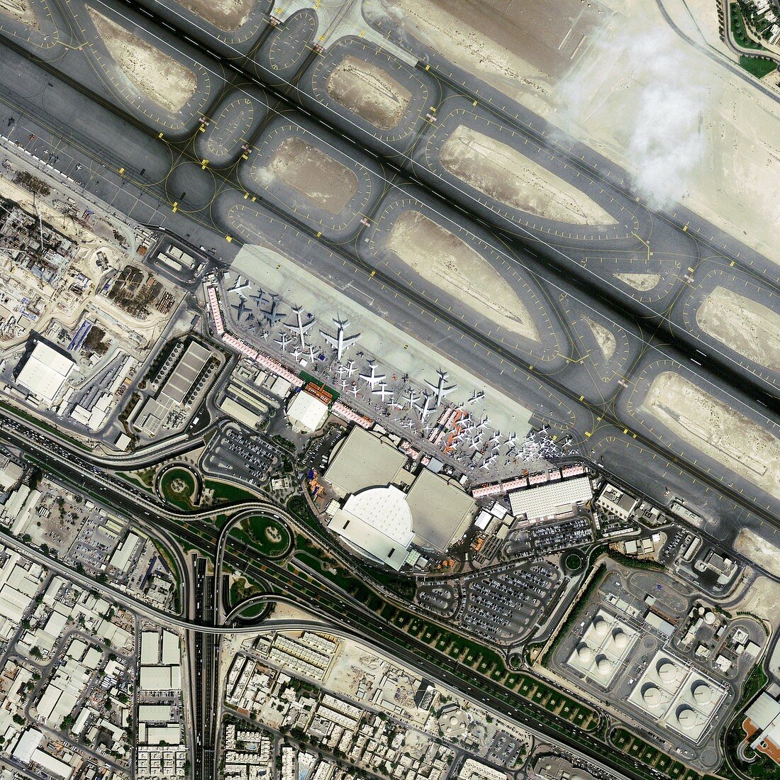
| Dubai Airshow,GeoEye-1 satellite image. North is at top. This is the exhibition area of Dubai International Airport during the Dubai Airshow of 2009. This airshow,held every two years,is the leading aerospace event in the Middle East. Hundreds of exhibits and aircraft are seen by tens of thousands over several days. Aeroplanes are at centre,with runways across upper right,and motorways across lower left. Image data obtained on 16 November 2009. The US-operated GeoEye-1 satellite was launched in September 2008,and orbits at a height of 680 kilometres. It is the world's highest resolution commercial Earth-imaging satellite | |
| Lizenzart: | Lizenzpflichtig |
| Credit: | Science Photo Library / Geoeye |
| Bildgröße: | 3000 px × 3000 px |
| Modell-Rechte: | nicht erforderlich |
| Eigentums-Rechte: | nicht erforderlich |
| Restrictions: | - |
Preise für dieses Bild ab 15 €
Universitäten & Organisationen
(Informationsmaterial Digital, Informationsmaterial Print, Lehrmaterial Digital etc.)
ab 15 €
Redaktionell
(Bücher, Bücher: Sach- und Fachliteratur, Digitale Medien (redaktionell) etc.)
ab 30 €
Werbung
(Anzeigen, Aussenwerbung, Digitale Medien, Fernsehwerbung, Karten, Werbemittel, Zeitschriften etc.)
ab 55 €
Handelsprodukte
(bedruckte Textilie, Kalender, Postkarte, Grußkarte, Verpackung etc.)
ab 75 €
Pauschalpreise
Rechtepakete für die unbeschränkte Bildnutzung in Print oder Online
ab 495 €
Keywords
- 21. Jahrhundert,
- Anzeige,
- Arabisch,
- Asiatisch,
- Asien,
- Ausstellung,
- Autobahn,
- Exponate,
- Flughafen,
- Flugschau,
- Flugzeug,
- Flugzeuge,
- Gebäude,
- GeoEye-1,
- geografisch,
- Geographie,
- Industrie,
- Industriell,
- Luftfahrt,
- Mittlerer Osten,
- Nahost,
- Satellit,
- Satellitenbild,
- Stadt,
- städtisch,
- Technologie,
- technologisch,
- Transport,
- Vereinigte Arabische Emirate,
- Weltall