Lunar map of 1854
Bildnummer 11591872
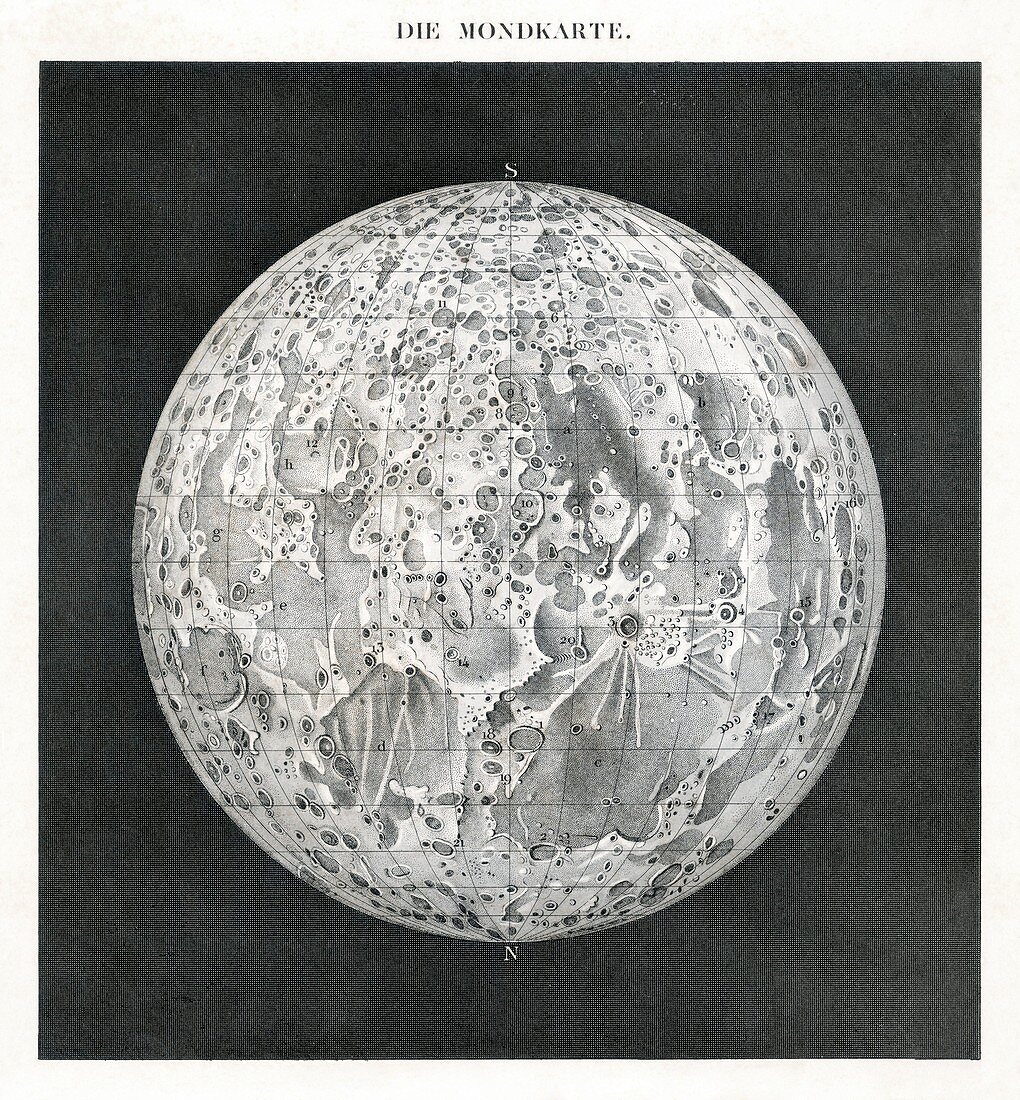
| Lunar map of 1854. This map of the Moon's surface was published in Germany,and the title across top in in German. The Moon is orientated with celestial North at bottom,and the surface is divided up by lines of latitude and longitude. Early astronomers,from the time of Galileo onwards,used their telescopes to draw lunar maps of increasing accuracy. The main features of such maps are the lowland maria (dark area),the surrounding highlands (white areas),and the impact craters and basins. It was not until space probes were launched in the 1960s that the far side of the Moon was seen for the first time | |
| Lizenzart: | Lizenzpflichtig |
| Credit: | Science Photo Library / Van Ravenswaay, Detlev |
| Bildgröße: | 4930 px × 5315 px |
| Modell-Rechte: | nicht erforderlich |
| Eigentums-Rechte: | nicht erforderlich |
| Restrictions: | - |
Preise für dieses Bild ab 15 €
Universitäten & Organisationen
(Informationsmaterial Digital, Informationsmaterial Print, Lehrmaterial Digital etc.)
ab 15 €
Redaktionell
(Bücher, Bücher: Sach- und Fachliteratur, Digitale Medien (redaktionell) etc.)
ab 30 €
Werbung
(Anzeigen, Aussenwerbung, Digitale Medien, Fernsehwerbung, Karten, Werbemittel, Zeitschriften etc.)
ab 55 €
Handelsprodukte
(bedruckte Textilie, Kalender, Postkarte, Grußkarte, Verpackung etc.)
ab 75 €
Pauschalpreise
Rechtepakete für die unbeschränkte Bildnutzung in Print oder Online
ab 495 €
Keywords
- 1800er Jahre,
- 19. Jahrhundert,
- Astronomie,
- astronomisch,
- ausgeschnitten,
- Ausschnitte,
- Ball,
- Beobachtungen,
- Blatt,
- Buch,
- Deutsche,
- Einfarbig,
- europäisch,
- Forschung,
- Geschichte,
- Globus,
- historisch,
- Illustration,
- Karte,
- Krater,
- Kreis,
- kreisförmig,
- Kugel,
- kugelförmig,
- Kunstwerk,
- Maria,
- Mond,
- Mond-,
- Observation,
- Planetenwissenschaft,
- Raum,
- rund,
- Schwarz und weiß,
- Sonnensystem,
- Stute,
- Zeichnung