Historical Chinese map
Bildnummer 11591830
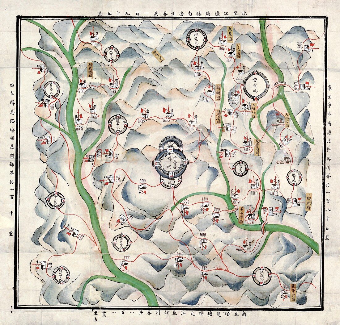
| Historical Chinese map. Pen and ink watercolour map of Xin xi ying yu tu,showing the fortress and existing military deployment of Xin xi ying in Xinping County,Yunnan,China. The relief of the land is shown pictorially. Created between 1770 and 1820 | |
| Lizenzart: | Lizenzpflichtig |
| Credit: | Science Photo Library / Library of Congress |
| Bildgröße: | 5419 px × 5185 px |
| Modell-Rechte: | nicht erforderlich |
| Eigentums-Rechte: | nicht erforderlich |
| Restrictions: | - |
Preise für dieses Bild ab 15 €
Universitäten & Organisationen
(Informationsmaterial Digital, Informationsmaterial Print, Lehrmaterial Digital etc.)
ab 15 €
Redaktionell
(Bücher, Bücher: Sach- und Fachliteratur, Digitale Medien (redaktionell) etc.)
ab 30 €
Werbung
(Anzeigen, Aussenwerbung, Digitale Medien, Fernsehwerbung, Karten, Werbemittel, Zeitschriften etc.)
ab 55 €
Handelsprodukte
(bedruckte Textilie, Kalender, Postkarte, Grußkarte, Verpackung etc.)
ab 75 €
Pauschalpreise
Rechtepakete für die unbeschränkte Bildnutzung in Print oder Online
ab 495 €