Navigation satellites,artwork
Bildnummer 11591449
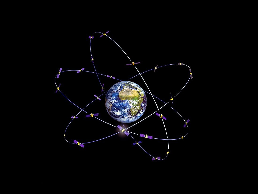
| Navigation satellites. Computer artwork of navigation satellites for the European Space Agency's satellite navigation network in orbit about the Earth. These satellites will transmit data for position (latitude and longitude) and height above sea level (elevation). The network is being set up in two steps. The first step will lead to a European overlay navigation system (EGNOS) using the two existing navigation satellite constellations (GPS and Glonass). The second step (Galileo) will consist of 30 satellites orbiting over 23,000 kilometres above the Earth and is scheduled to begin operating by 2014. The network will be used for car,train and aircraft guidance,rescue services,and road use taxation. Solar panels (blue) provide power for each satellite | |
| Lizenzart: | Lizenzpflichtig |
| Credit: | Science Photo Library / Huart, J. / ESA |
| Bildgröße: | 4039 px × 3031 px |
| Modell-Rechte: | nicht erforderlich |
| Eigentums-Rechte: | nicht erforderlich |
| Restrictions: |
|
Preise für dieses Bild ab 15 €
Universitäten & Organisationen
(Informationsmaterial Digital, Informationsmaterial Print, Lehrmaterial Digital etc.)
ab 15 €
Redaktionell
(Bücher, Bücher: Sach- und Fachliteratur, Digitale Medien (redaktionell) etc.)
ab 30 €
Werbung
(Anzeigen, Aussenwerbung, Digitale Medien, Fernsehwerbung, Karten, Werbemittel, Zeitschriften etc.)
ab 55 €
Handelsprodukte
(bedruckte Textilie, Kalender, Postkarte, Grußkarte, Verpackung etc.)
ab 75 €
Pauschalpreise
Rechtepakete für die unbeschränkte Bildnutzung in Print oder Online
ab 495 €
Keywords
- 2014,
- 21. Jahrhundert,
- ausgeschnitten,
- Ausrüstung,
- Ausschnitte,
- Daten,
- EGNOS,
- Erde,
- esa,
- Europäische Weltraumbehörde,
- GLONASS,
- Illustration,
- Industrie,
- Industriell,
- Kommunikation,
- Komplett,
- Kunstwerk,
- Maschine,
- Navigation,
- Netzwerk,
- Orbit,
- Planet,
- Raum,
- Satellit,
- schwarzer Hintergrund,
- Sonnensystem,
- Sternbilder,
- Technologie,
- technologisch,
- Telekommunikation,
- Transport,
- Übermittlung,
- umkreisend,
- Umlaufbahnen,
- Weltraumflug