Map of European region,1552
Bildnummer 11589736
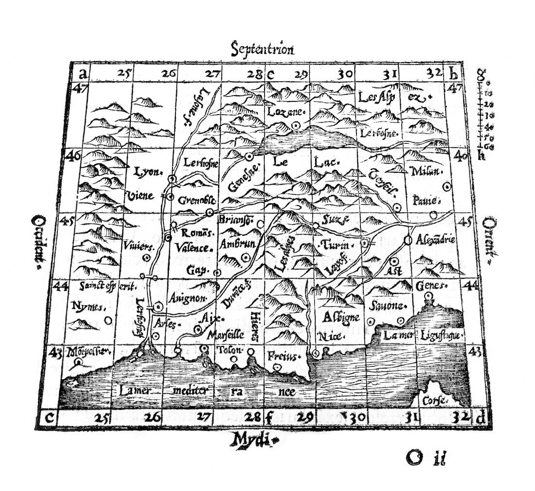
| Map of European region,16th century. This map shows the border area between south-eastern France,north-western Italy,and Switzerland,with cities,rivers and mountains marked. The text labels are in Latin,including the compass points. Lines of latitude and longitude and a scale (upper right) are also included. The Mediterranean coast (bottom) and Lake Geneva (upper centre) are also shown. This map is from the 1552 edition of Sphaera Mundi (Sphere of the World),by the French mathematician and cartographer Oronce Fine (1494-1555). This was an astronomy textbook with woodcut illustrations by Fine. It was first published in 1542 | |
| Lizenzart: | Lizenzpflichtig |
| Credit: | Science Photo Library / Royal Astronomical Society |
| Bildgröße: | 4391 px × 4035 px |
| Modell-Rechte: | nicht erforderlich |
| Eigentums-Rechte: | nicht erforderlich |
| Restrictions: | - |
Preise für dieses Bild ab 15 €
Universitäten & Organisationen
(Informationsmaterial Digital, Informationsmaterial Print, Lehrmaterial Digital etc.)
ab 15 €
Redaktionell
(Bücher, Bücher: Sach- und Fachliteratur, Digitale Medien (redaktionell) etc.)
ab 30 €
Werbung
(Anzeigen, Aussenwerbung, Digitale Medien, Fernsehwerbung, Karten, Werbemittel, Zeitschriften etc.)
ab 55 €
Handelsprodukte
(bedruckte Textilie, Kalender, Postkarte, Grußkarte, Verpackung etc.)
ab 75 €
Pauschalpreise
Rechtepakete für die unbeschränkte Bildnutzung in Print oder Online
ab 495 €
Keywords
- 1500er Jahre,
- 16. Jahrhundert,
- Alpen,
- alpin,
- Astronomie,
- astronomisch,
- Berg,
- Blatt,
- Buch,
- Diagramm,
- Einfarbig,
- europäisch,
- Forschung,
- Frankreich,
- Französisch,
- Genfer See,
- Geschichte,
- Geschichte der Wissenschaft,
- historisch,
- Illustration,
- Italien,
- Italienisch,
- Karte,
- Kunstwerk,
- Küste,
- Latein,
- Mittelmeer,
- Renaissance,
- Schwarz und weiß,
- Schweiz,
- schweizerisch,
- wissenschaftliche Revolution