2005 Kashmir earthquake,satellite image
Bildnummer 11589448
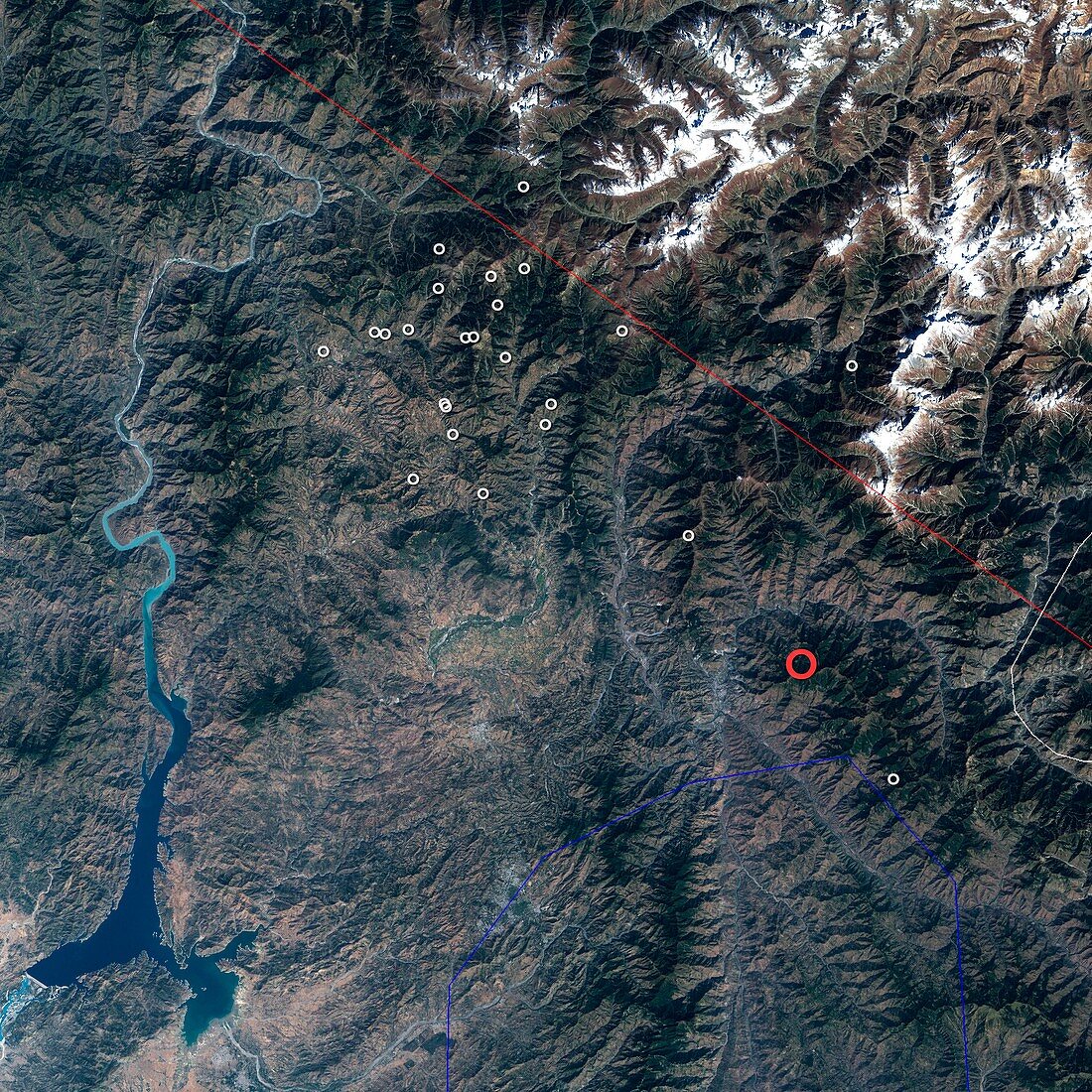
| 2005 Kashmir earthquake,Landsat 7 satellite image. This earthquake,which struck the Pakistani region of Kashmir,occurred at 3:50am GMT on 8th October 2005. It had a magnitude of 7.6,and led to the deaths of nearly 100,000 people. The epicentre is marked by the red circle. Aftershocks are marked by white circles. The region lies where the Indian tectonic plate collides with the Eurasian tectonic plate. This collision,which began some 50 million years ago,formed the Himalaya mountain range | |
| Lizenzart: | Lizenzpflichtig |
| Credit: | Science Photo Library / NASA |
| Bildgröße: | 4000 px × 4000 px |
| Modell-Rechte: | nicht erforderlich |
| Eigentums-Rechte: | nicht erforderlich |
| Restrictions: | - |
Preise für dieses Bild ab 15 €
Universitäten & Organisationen
(Informationsmaterial Digital, Informationsmaterial Print, Lehrmaterial Digital etc.)
ab 15 €
Redaktionell
(Bücher, Bücher: Sach- und Fachliteratur, Digitale Medien (redaktionell) etc.)
ab 30 €
Werbung
(Anzeigen, Aussenwerbung, Digitale Medien, Fernsehwerbung, Karten, Werbemittel, Zeitschriften etc.)
ab 55 €
Handelsprodukte
(bedruckte Textilie, Kalender, Postkarte, Grußkarte, Verpackung etc.)
ab 75 €
Pauschalpreise
Rechtepakete für die unbeschränkte Bildnutzung in Print oder Online
ab 495 €