Mercury map,1977
Bildnummer 11589370
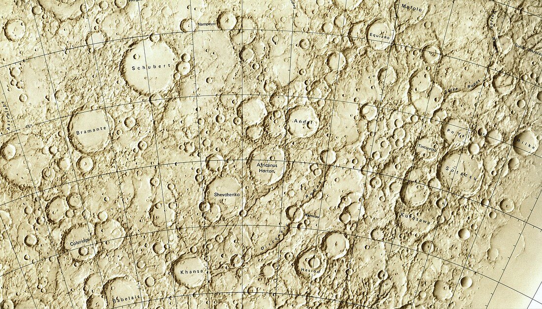
| Mercury map,1977. Part of the cratered surface of Mercury as shown in a 1977 map issued for NASA by the National Geological Survey in the USA. Mercury's surface includes heavy cratering,showing that it has been geologically inactive for billions of years. Initial maps of Mercury were made based on the data received from the 1975 Mariner flyby. The planned MESSENGER mapping mission (2011) will allow more detailed maps to be produced. Other features seen on Mercury include Dorsa (ridges),Montes (mountains),Planitiae,(plains),Rupes (escarpments),and Valles (valleys) | |
| Lizenzart: | Lizenzpflichtig |
| Credit: | Science Photo Library / Van Ravenswaay, Detlev |
| Bildgröße: | 5540 px × 3165 px |
| Modell-Rechte: | nicht erforderlich |
| Eigentums-Rechte: | nicht erforderlich |
| Restrictions: | - |
Preise für dieses Bild ab 15 €
Universitäten & Organisationen
(Informationsmaterial Digital, Informationsmaterial Print, Lehrmaterial Digital etc.)
ab 15 €
Redaktionell
(Bücher, Bücher: Sach- und Fachliteratur, Digitale Medien (redaktionell) etc.)
ab 30 €
Werbung
(Anzeigen, Aussenwerbung, Digitale Medien, Fernsehwerbung, Karten, Werbemittel, Zeitschriften etc.)
ab 55 €
Handelsprodukte
(bedruckte Textilie, Kalender, Postkarte, Grußkarte, Verpackung etc.)
ab 75 €
Pauschalpreise
Rechtepakete für die unbeschränkte Bildnutzung in Print oder Online
ab 495 €
Keywords
- 1900er Jahre,
- 20. Jahrhundert,
- Amerikanisch,
- Astronomie,
- astronomisch,
- Berge,
- Geologie,
- geologisch,
- Gitter,
- Illustration,
- Karte,
- Kartographie,
- Krater,
- Kunstwerk,
- Linien,
- Merkur,
- Montes,
- NASA,
- NGS,
- Oberfläche,
- Planetenwissenschaft,
- Raum,
- Satellit,
- Sonnensystem,
- Täler,
- uns,
- valles,
- Weltraumrennen,
- Weltraumsonde