Deforestation in the Amazon,2001
Bildnummer 11588984
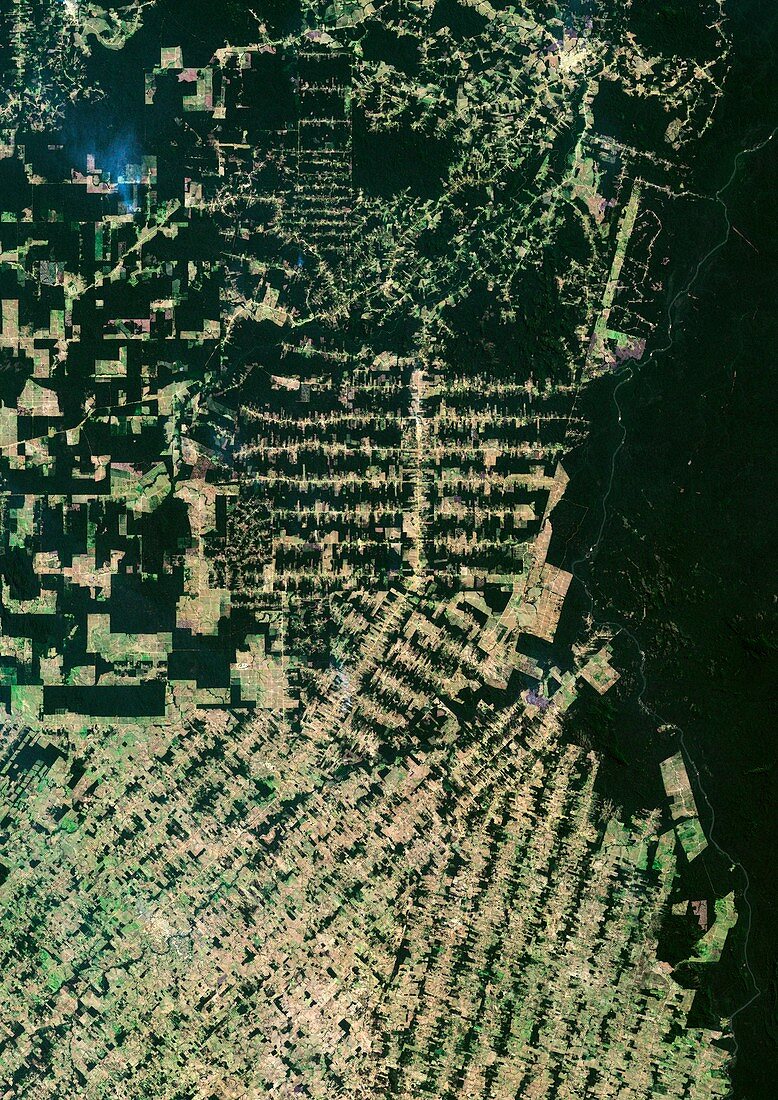
| Deforestation in the Amazon. True colour Landsat satellite image of the Eastern part of the state of Rondonia in Brazil,showing areas of deforestation (light green and brown). Between 1970 and 2000 over 575,000 square kilometres of forest were lost. Since 2000 the rate of loss per year has increased. Deforestation is normally undertaken to create grazing areas for cattle. The removal of trees leaves soil exposed to rapid erosion by water,leading to the removal of valuable top soil. Image taken in 2001 | |
| Lizenzart: | Lizenzpflichtig |
| Credit: | Science Photo Library / Planetobserver |
| Bildgröße: | 3520 px × 4979 px |
| Modell-Rechte: | nicht erforderlich |
| Eigentums-Rechte: | nicht erforderlich |
| Restrictions: | - |
Preise für dieses Bild ab 15 €
Universitäten & Organisationen
(Informationsmaterial Digital, Informationsmaterial Print, Lehrmaterial Digital etc.)
ab 15 €
Redaktionell
(Bücher, Bücher: Sach- und Fachliteratur, Digitale Medien (redaktionell) etc.)
ab 30 €
Werbung
(Anzeigen, Aussenwerbung, Digitale Medien, Fernsehwerbung, Karten, Werbemittel, Zeitschriften etc.)
ab 55 €
Handelsprodukte
(bedruckte Textilie, Kalender, Postkarte, Grußkarte, Verpackung etc.)
ab 75 €
Pauschalpreise
Rechtepakete für die unbeschränkte Bildnutzung in Print oder Online
ab 495 €