West Mata underwater volcano,altimetry
Bildnummer 11584512
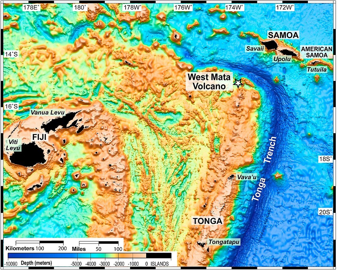
| West Mata underwater volcano. Altimetric map of the bed of the northeast Lau Basin in the south Pacific Ocean showing the West Mata volcano. West Mata was discovered in May 2009 and is the deepest erupting volcano yet discovered. It lies 4000 feet (1.2 kilometres) below the surface of the Pacific Ocean,in an area bounded by Fiji,Tonga and Samoa. Altimetric maps show the relative heights/depths of geographic features,here it shows the shape of the sea floor | |
| Lizenzart: | Lizenzpflichtig |
| Credit: | Science Photo Library / NOAA |
| Bildgröße: | 4705 px × 3780 px |
| Modell-Rechte: | nicht erforderlich |
| Eigentums-Rechte: | nicht erforderlich |
| Restrictions: |
|
Preise für dieses Bild ab 15 €
Universitäten & Organisationen
(Informationsmaterial Digital, Informationsmaterial Print, Lehrmaterial Digital etc.)
ab 15 €
Redaktionell
(Bücher, Bücher: Sach- und Fachliteratur, Digitale Medien (redaktionell) etc.)
ab 30 €
Werbung
(Anzeigen, Aussenwerbung, Digitale Medien, Fernsehwerbung, Karten, Werbemittel, Zeitschriften etc.)
ab 55 €
Handelsprodukte
(bedruckte Textilie, Kalender, Postkarte, Grußkarte, Verpackung etc.)
ab 75 €
Pauschalpreise
Rechtepakete für die unbeschränkte Bildnutzung in Print oder Online
ab 495 €