Chile 2010 earthquake,world map
Bildnummer 11572241
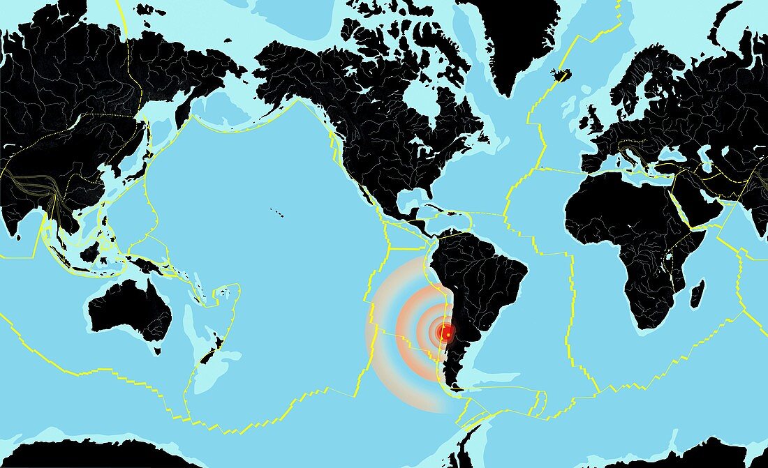
| Chile 2010 earthquake. World map showing the location and seismic waves (red concentric circles) of the large 8.8 moment magnitude earthquake that struck off the coast of Chile on 27 February 2010. This was one of the largest earthquakes ever. Several hundred people died and there were many powerful aftershocks. The map also shows the boundaries (yellow lines) of the tectonic plates that make up the Earth's crust,the continents (black),the oceans (blue) and the continental shelves (light blue). Tectonic plates move over the molten rock below them,colliding with and moving past,under and over each other. Immense pressures can build up,which are released during an earthquake | |
| Lizenzart: | Lizenzpflichtig |
| Credit: | Science Photo Library / Hks, Gary |
| Bildgröße: | 5400 px × 3295 px |
| Modell-Rechte: | nicht erforderlich |
| Eigentums-Rechte: | nicht erforderlich |
| Restrictions: | - |
Preise für dieses Bild ab 15 €
Universitäten & Organisationen
(Informationsmaterial Digital, Informationsmaterial Print, Lehrmaterial Digital etc.)
ab 15 €
Redaktionell
(Bücher, Bücher: Sach- und Fachliteratur, Digitale Medien (redaktionell) etc.)
ab 30 €
Werbung
(Anzeigen, Aussenwerbung, Digitale Medien, Fernsehwerbung, Karten, Werbemittel, Zeitschriften etc.)
ab 55 €
Handelsprodukte
(bedruckte Textilie, Kalender, Postkarte, Grußkarte, Verpackung etc.)
ab 75 €
Pauschalpreise
Rechtepakete für die unbeschränkte Bildnutzung in Print oder Online
ab 495 €
Keywords
- 2010,
- 21. Jahrhundert,
- Chile,
- Chilenisch,
- Energie,
- Epizentrum,
- Erdbeben,
- Erde,
- Erdkunde,
- Februar,
- geografisch,
- Geographie,
- Geologie,
- geologisch,
- Geowissenschaften,
- Grenze,
- Grenzen,
- groß,
- Illustration,
- Karte,
- Kontinente,
- kraftvoll,
- Kunstwerk,
- Lehrbuchwissenschaft,
- Linien,
- mächtig,
- massiv,
- Naturkatastrophe,
- Naturwissenschaft in der Schule,
- Ort,
- Plattentektonik,
- Seismologie,
- stark,
- Südamerika,
- Südamerikanisch,
- tektonischen Platten,
- Welt,
- weltweit,
- Zonen