Lena Delta,satellite radar image
Bildnummer 11570160
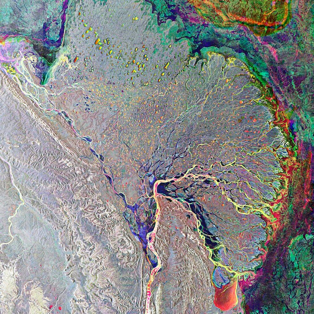
| Lena Delta,satellite radar image. North is at top. This river flows 4400 kilometres from south-central Russia,to this delta on the Arctic coast of north-west Russia. At the delta,the water spreads out through numerous channels,depositing its silt to build the land of the delta,before emptying into the Laptev Sea. The delta is frozen in the winter,but in summer it is a thriving wetland. This composite of three images was obtained in 2007 and 2008 from the ASAR (Advanced Synthetic Aperture Radar) instrument on the European Space Agency's (ESA) Envisat (Environmental Satellite) | |
| Lizenzart: | Lizenzpflichtig |
| Credit: | Science Photo Library / ESA |
| Bildgröße: | 4205 px × 4205 px |
| Modell-Rechte: | nicht erforderlich |
| Eigentums-Rechte: | nicht erforderlich |
| Restrictions: |
|
Preise für dieses Bild ab 15 €
Universitäten & Organisationen
(Informationsmaterial Digital, Informationsmaterial Print, Lehrmaterial Digital etc.)
ab 15 €
Redaktionell
(Bücher, Bücher: Sach- und Fachliteratur, Digitale Medien (redaktionell) etc.)
ab 30 €
Werbung
(Anzeigen, Aussenwerbung, Digitale Medien, Fernsehwerbung, Karten, Werbemittel, Zeitschriften etc.)
ab 55 €
Handelsprodukte
(bedruckte Textilie, Kalender, Postkarte, Grußkarte, Verpackung etc.)
ab 75 €
Pauschalpreise
Rechtepakete für die unbeschränkte Bildnutzung in Print oder Online
ab 495 €
Keywords
- 21. Jahrhundert,
- Arktis,
- Arktischer Ozean,
- Asiatisch,
- Asien,
- Einlagen,
- Erdbeobachtung,
- esa,
- Europa,
- Europäische Weltraumbehörde,
- Feuchtgebiet,
- Gefroren,
- geografisch,
- Geographie,
- Kanal,
- Kanäle,
- Küste,
- Küsten-,
- Küstenlinie,
- Land,
- Meer,
- neues Land,
- Russland,
- Satellit,
- Satellitenbild,
- Schlick,
- Sediment,
- Sibirien,
- Sumpf,
- Verzweigung,
- Wasser,
- Weltall