Bosphorus Strait,satellite radar image
Bildnummer 11570159
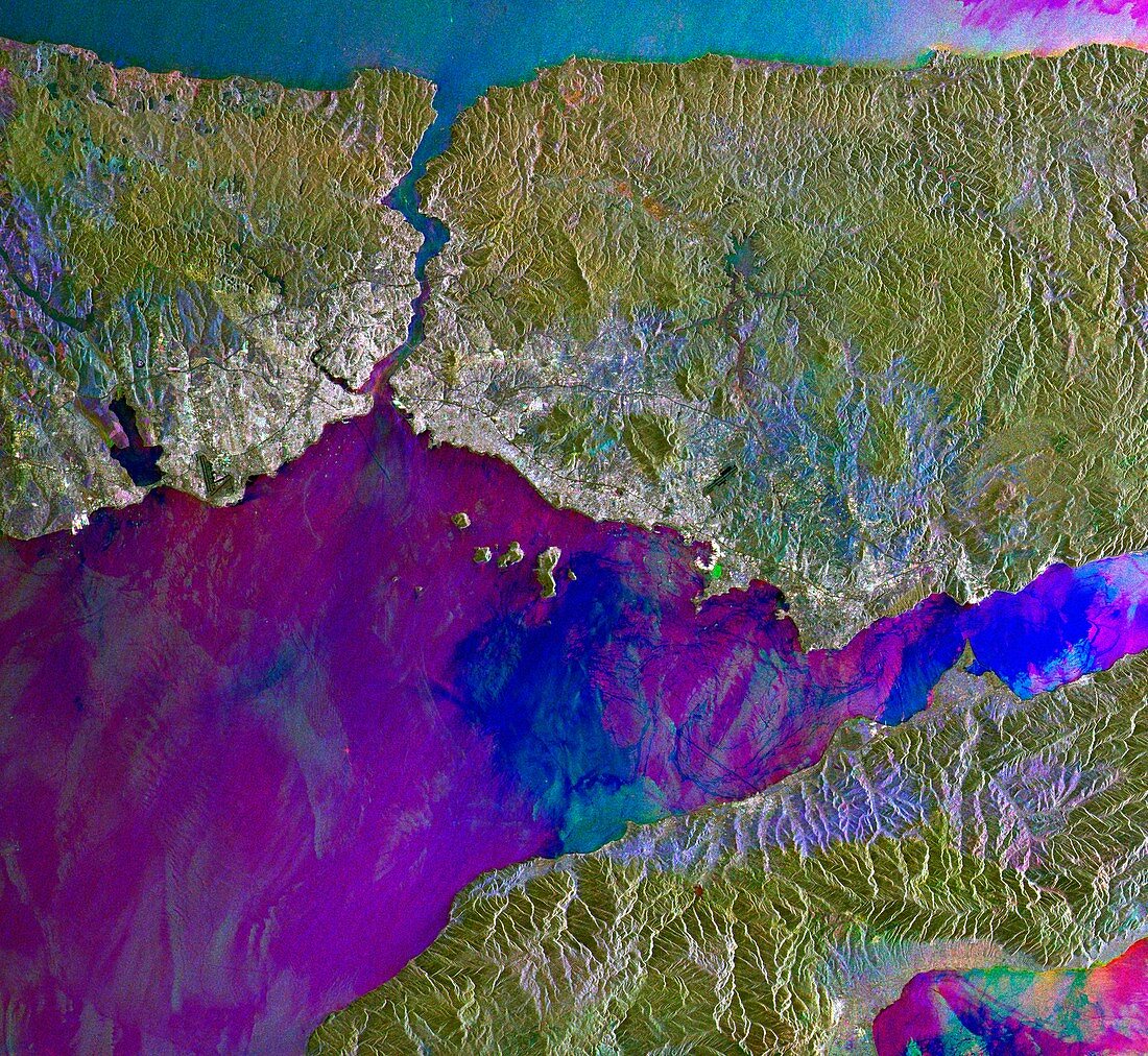
| Bosphorus Strait,satellite radar image. North is at top. Land is green,light blue and grey. Water is dark blue and pueple. The Bosphorus Strait is the 30-kilometre-long narrow channel at upper left,connecting the Sea of Marmara (bottom) with the Black Sea (top). Istanbul,the largest city in Turkey,is the grey area straddling the southern end of the Bosphorus. This composite of three images was obtained in 2004 using the SAR (Synthetic Aperture Radar) instrument on the European Space Agency's (ESA) Envisat (Environmental Satellite) | |
| Lizenzart: | Lizenzpflichtig |
| Credit: | Science Photo Library / ESA |
| Bildgröße: | 4377 px × 4028 px |
| Modell-Rechte: | nicht erforderlich |
| Eigentums-Rechte: | nicht erforderlich |
| Restrictions: |
|
Preise für dieses Bild ab 15 €
Universitäten & Organisationen
(Informationsmaterial Digital, Informationsmaterial Print, Lehrmaterial Digital etc.)
ab 15 €
Redaktionell
(Bücher, Bücher: Sach- und Fachliteratur, Digitale Medien (redaktionell) etc.)
ab 30 €
Werbung
(Anzeigen, Aussenwerbung, Digitale Medien, Fernsehwerbung, Karten, Werbemittel, Zeitschriften etc.)
ab 55 €
Handelsprodukte
(bedruckte Textilie, Kalender, Postkarte, Grußkarte, Verpackung etc.)
ab 75 €
Pauschalpreise
Rechtepakete für die unbeschränkte Bildnutzung in Print oder Online
ab 495 €