Hebes Chasma,Mars,satellite image
Bildnummer 11570145
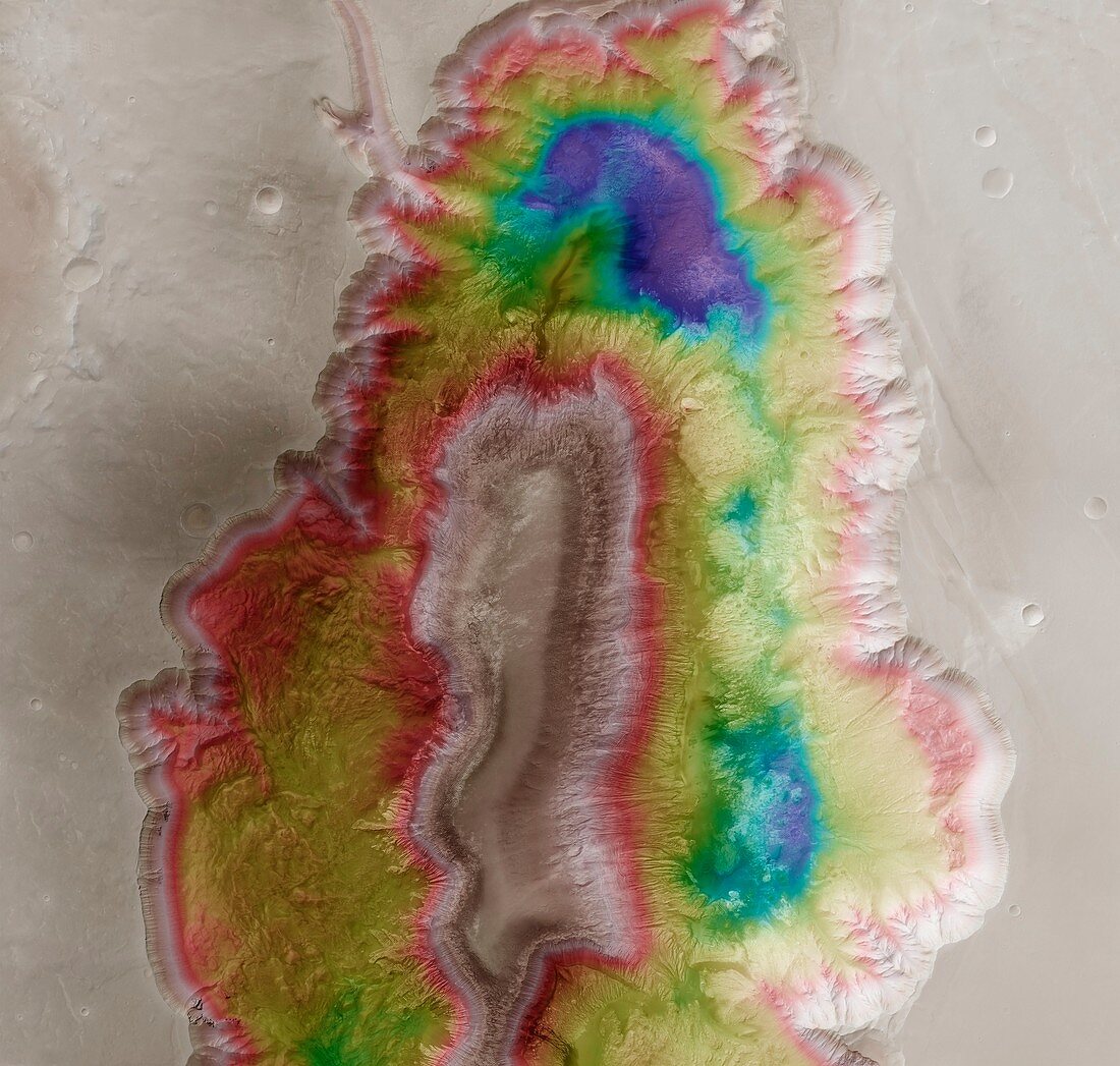
| Hebes Chasma,Mars,height-colour-coded satellite image. This is an overhead orthographic image: white and red areas are highest,and blue and purple areas are lowest. Hebes Chasma is an 8-kilometre-deep trough formed by volcanic activity. It is some 300 kilometres long,and in its centre is a flat-topped tableland. It is thought that groundwater once flowed through this canyon,and the tableland also has multiple erosion gullies on its sides. The image data is from the High Resolution Stereo Camera (HRSC) on board the European Space Agency's (ESA) Mars Express Orbiter | |
| Lizenzart: | Lizenzpflichtig |
| Credit: | Science Photo Library / Neukum, G. / FU Berlin / ESA / DLR |
| Bildgröße: | 4305 px × 4098 px |
| Modell-Rechte: | nicht erforderlich |
| Eigentums-Rechte: | nicht erforderlich |
| Restrictions: |
|
Preise für dieses Bild ab 15 €
Universitäten & Organisationen
(Informationsmaterial Digital, Informationsmaterial Print, Lehrmaterial Digital etc.)
ab 15 €
Redaktionell
(Bücher, Bücher: Sach- und Fachliteratur, Digitale Medien (redaktionell) etc.)
ab 30 €
Werbung
(Anzeigen, Aussenwerbung, Digitale Medien, Fernsehwerbung, Karten, Werbemittel, Zeitschriften etc.)
ab 55 €
Handelsprodukte
(bedruckte Textilie, Kalender, Postkarte, Grußkarte, Verpackung etc.)
ab 75 €
Pauschalpreise
Rechtepakete für die unbeschränkte Bildnutzung in Print oder Online
ab 495 €
Keywords
- 21. Jahrhundert,
- Astronomie,
- astronomisch,
- bewegliche Flüssigkeit,
- Draufsicht,
- erodiert,
- Erosion,
- farbcodiert,
- Fließen,
- Fluid,
- geografisch,
- Geographie,
- Geschnitzt,
- Hebes Chasma,
- hochauflösende Stereokamera,
- HRSC,
- Klippe,
- Klippen,
- Mars,
- mars Express,
- Mesa,
- Orange,
- Planet,
- Planetenwissenschaft,
- Plateau,
- Satellit,
- Satellitenbild,
- Schlucht,
- Schluchten,
- Sonnensystem,
- Tal,
- Täler,
- Tief,
- vom Mars,
- Wasser,
- Wasserrinne,
- Weltall