Martian terrain,satellite image
Bildnummer 11569073
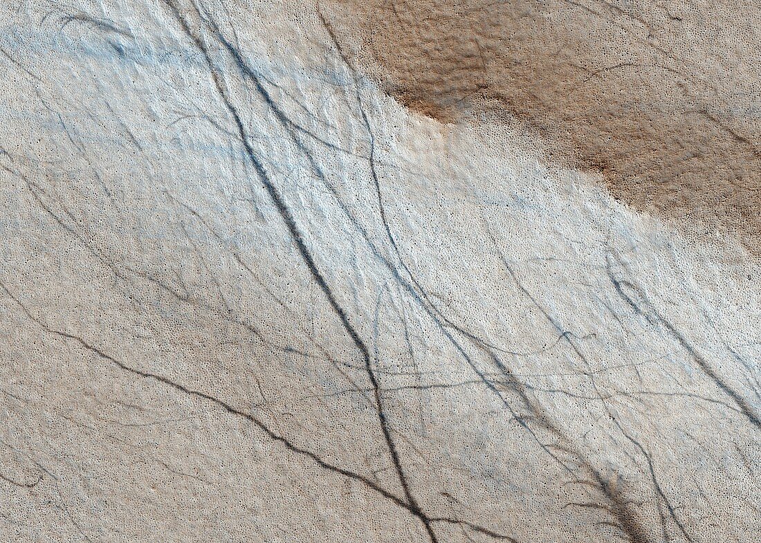
| Martian terrain. Coloured satellite image of the surface of Mars in the southern hemisphere. The surface is marked with numerous dark trails of unknown origin. A raised ridge (upper right) is a common landform on Mars and was formed when layers of rock and sediment break and fold under compression. Image obtained by the High Resolution Imaging Science Experiment (HiRISE) camera on NASA's Mars Reconnaissance Orbiter (MRO) on 17th June 2009. The width of this image is roughly 1.2 kilometres across | |
| Lizenzart: | Lizenzpflichtig |
| Credit: | Science Photo Library / NASA / JPL / University of Arizona |
| Bildgröße: | 5672 px × 4048 px |
| Modell-Rechte: | nicht erforderlich |
| Eigentums-Rechte: | nicht erforderlich |
| Restrictions: | - |
Preise für dieses Bild ab 15 €
Universitäten & Organisationen
(Informationsmaterial Digital, Informationsmaterial Print, Lehrmaterial Digital etc.)
ab 15 €
Redaktionell
(Bücher, Bücher: Sach- und Fachliteratur, Digitale Medien (redaktionell) etc.)
ab 30 €
Werbung
(Anzeigen, Aussenwerbung, Digitale Medien, Fernsehwerbung, Karten, Werbemittel, Zeitschriften etc.)
ab 55 €
Handelsprodukte
(bedruckte Textilie, Kalender, Postkarte, Grußkarte, Verpackung etc.)
ab 75 €
Pauschalpreise
Rechtepakete für die unbeschränkte Bildnutzung in Print oder Online
ab 495 €
Keywords
- 21. Jahrhundert,
- Dünen,
- Erosion,
- geografisch,
- Geographie,
- Geologie,
- geologisch,
- Grat,
- HiRISE,
- hochauflösende Bildgebung,
- Hügel,
- Landform,
- Mars,
- MRO,
- Muster,
- NASA,
- Oberfläche,
- Planetenwissenschaft,
- Sanddüne,
- Sanddünen,
- Satellitenbild,
- Sonnensystem,
- Spuren,
- Terrain,
- trocken,
- vom Mars,
- Weg,
- Weltall,
- Weltraummission