2010 Haiti earthquake intensity map
Bildnummer 11568486
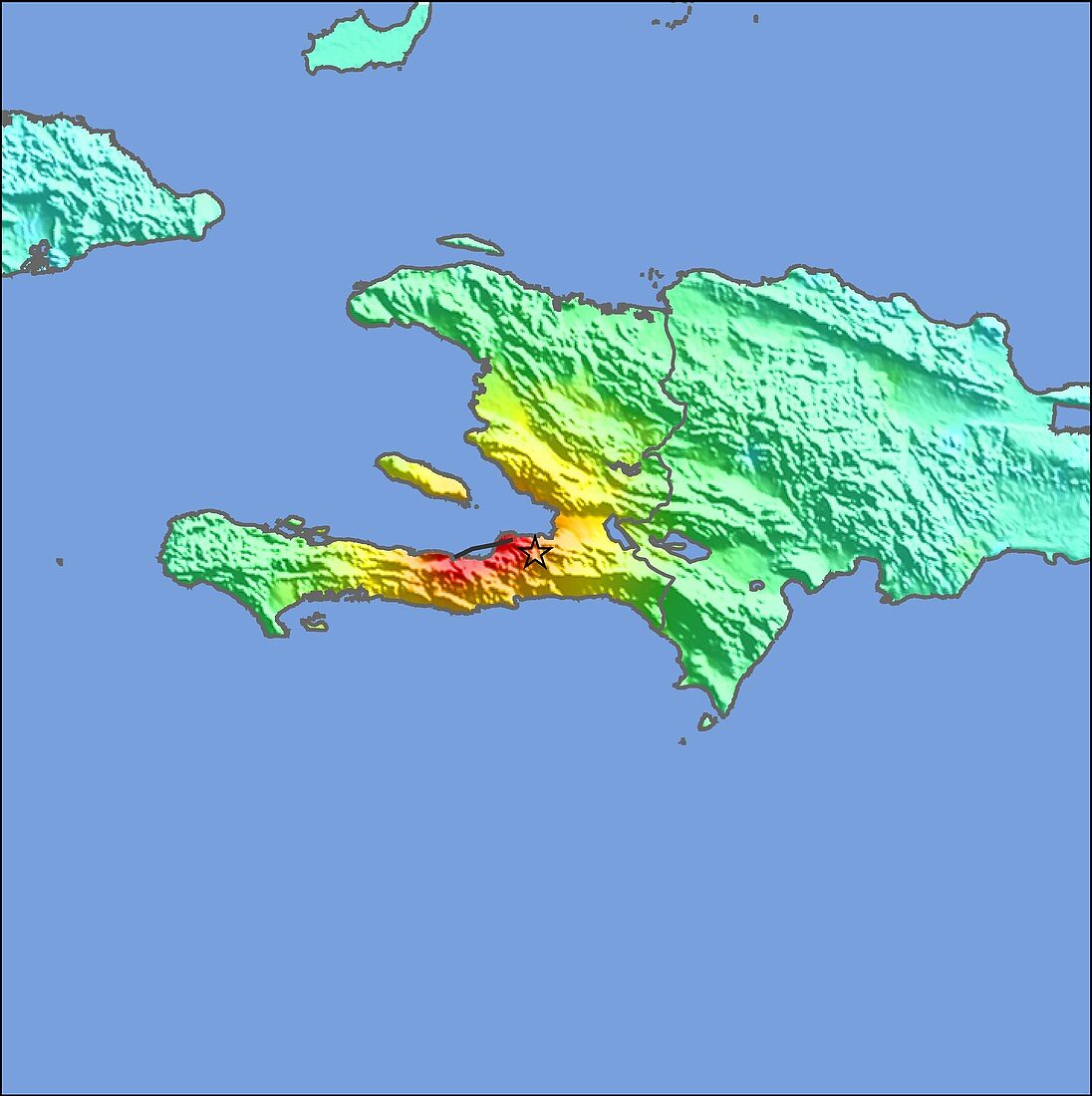
| 2010 Haiti earthquake intensity map. Colour-coded map showing the intensity of earth tremors felt in Haiti (centre) and the surrounding region during an earthquake that struck on 12th January 2010 at 4.53pm local time (9.53pm GMT). The epicentre of the quake,which measured 7.0 on the Richter scale,is marked by the black star. The colours on the land show the intensity of the shaking,from red (extreme) and orange (severe),through yellow (strong) and green (moderate),to blue (weak) and white (not felt) | |
| Lizenzart: | Lizenzpflichtig |
| Credit: | Science Photo Library / US Geological Survey |
| Bildgröße: | 4500 px × 4518 px |
| Modell-Rechte: | nicht erforderlich |
| Eigentums-Rechte: | nicht erforderlich |
| Restrictions: | - |
Preise für dieses Bild ab 15 €
Universitäten & Organisationen
(Informationsmaterial Digital, Informationsmaterial Print, Lehrmaterial Digital etc.)
ab 15 €
Redaktionell
(Bücher, Bücher: Sach- und Fachliteratur, Digitale Medien (redaktionell) etc.)
ab 30 €
Werbung
(Anzeigen, Aussenwerbung, Digitale Medien, Fernsehwerbung, Karten, Werbemittel, Zeitschriften etc.)
ab 55 €
Handelsprodukte
(bedruckte Textilie, Kalender, Postkarte, Grußkarte, Verpackung etc.)
ab 75 €
Pauschalpreise
Rechtepakete für die unbeschränkte Bildnutzung in Print oder Online
ab 495 €