Chesapeake Bay crater,satellite image
Bildnummer 11564851
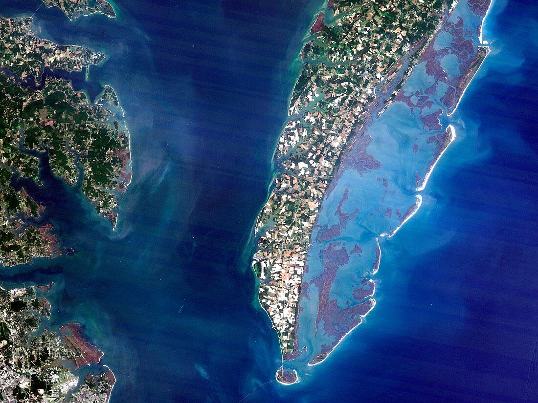
| Chesapeake Bay crater,satellite image. Satellite image of Chesapeake Bay,Virginia,USA. This is the location of the underwater Chesapeake Bay impact crater,which is thought to have been formed by a bolide that impacted the eastern shore of North America about 35 million years ago,during the late Eocene epoch. It is one of the best-preserved 'wet-target' or marine impact craters,and the largest impact crater in the USA | |
| Lizenzart: | Lizenzpflichtig |
| Credit: | Science Photo Library / Planetobserver |
| Bildgröße: | 4843 px × 3632 px |
| Modell-Rechte: | nicht erforderlich |
| Eigentums-Rechte: | nicht erforderlich |
| Restrictions: | - |
Preise für dieses Bild ab 15 €
Universitäten & Organisationen
(Informationsmaterial Digital, Informationsmaterial Print, Lehrmaterial Digital etc.)
ab 15 €
Redaktionell
(Bücher, Bücher: Sach- und Fachliteratur, Digitale Medien (redaktionell) etc.)
ab 30 €
Werbung
(Anzeigen, Aussenwerbung, Digitale Medien, Fernsehwerbung, Karten, Werbemittel, Zeitschriften etc.)
ab 55 €
Handelsprodukte
(bedruckte Textilie, Kalender, Postkarte, Grußkarte, Verpackung etc.)
ab 75 €
Pauschalpreise
Rechtepakete für die unbeschränkte Bildnutzung in Print oder Online
ab 495 €