Cape Verde,satellite image
Bildnummer 11564120
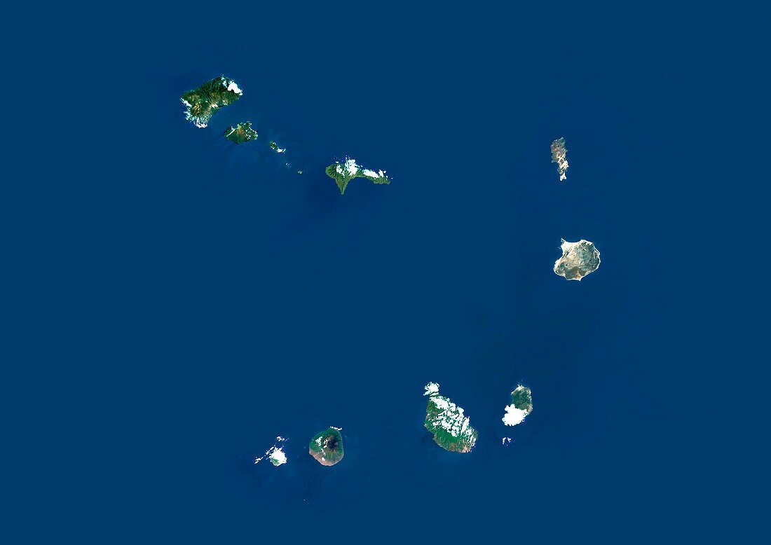
| Cape Verde,satellite image. North is at top. Water is blue,vegetation is green,and clouds are white. The Cape Verde is an archipelago of ten volcanic islands,and is located in the Atlantic Ocean off the coast of North Africa. The area shown here is several hundred kilometres across. The islands are divided into two groups,the Barlavento (windward) islands (across top) and the Sotavento (leeward) islands (across bottom). The largest island,Santiago,is at lower right. Image data obtained by the Landsat 5 and Landsat 7 satellites | |
| Lizenzart: | Lizenzpflichtig |
| Credit: | Science Photo Library / Planetobserver |
| Bildgröße: | 4994 px × 3531 px |
| Modell-Rechte: | nicht erforderlich |
| Eigentums-Rechte: | nicht erforderlich |
| Restrictions: | - |
Preise für dieses Bild ab 15 €
Universitäten & Organisationen
(Informationsmaterial Digital, Informationsmaterial Print, Lehrmaterial Digital etc.)
ab 15 €
Redaktionell
(Bücher, Bücher: Sach- und Fachliteratur, Digitale Medien (redaktionell) etc.)
ab 30 €
Werbung
(Anzeigen, Aussenwerbung, Digitale Medien, Fernsehwerbung, Karten, Werbemittel, Zeitschriften etc.)
ab 55 €
Handelsprodukte
(bedruckte Textilie, Kalender, Postkarte, Grußkarte, Verpackung etc.)
ab 75 €
Pauschalpreise
Rechtepakete für die unbeschränkte Bildnutzung in Print oder Online
ab 495 €
Keywords
- Afrika,
- Afrikanisch,
- Archipel,
- Atlantischer Ozean,
- Barlavento,
- Erdbeobachtung,
- geografisch,
- Geographie,
- Geowissenschaften,
- Grenzen,
- Insel,
- Inseln,
- Kap Verde,
- Kartographie,
- Küste,
- Küsten-,
- Küstenlinie,
- Land,
- Landsat 7,
- Meer,
- Nation,
- Ozean,
- Rand,
- Sao Vicente,
- Satellit,
- Satellitenbild,
- Topographie,
- Umwelt,
- Wasser,
- Weltall