Guadeloupe,satellite image
Bildnummer 11564062
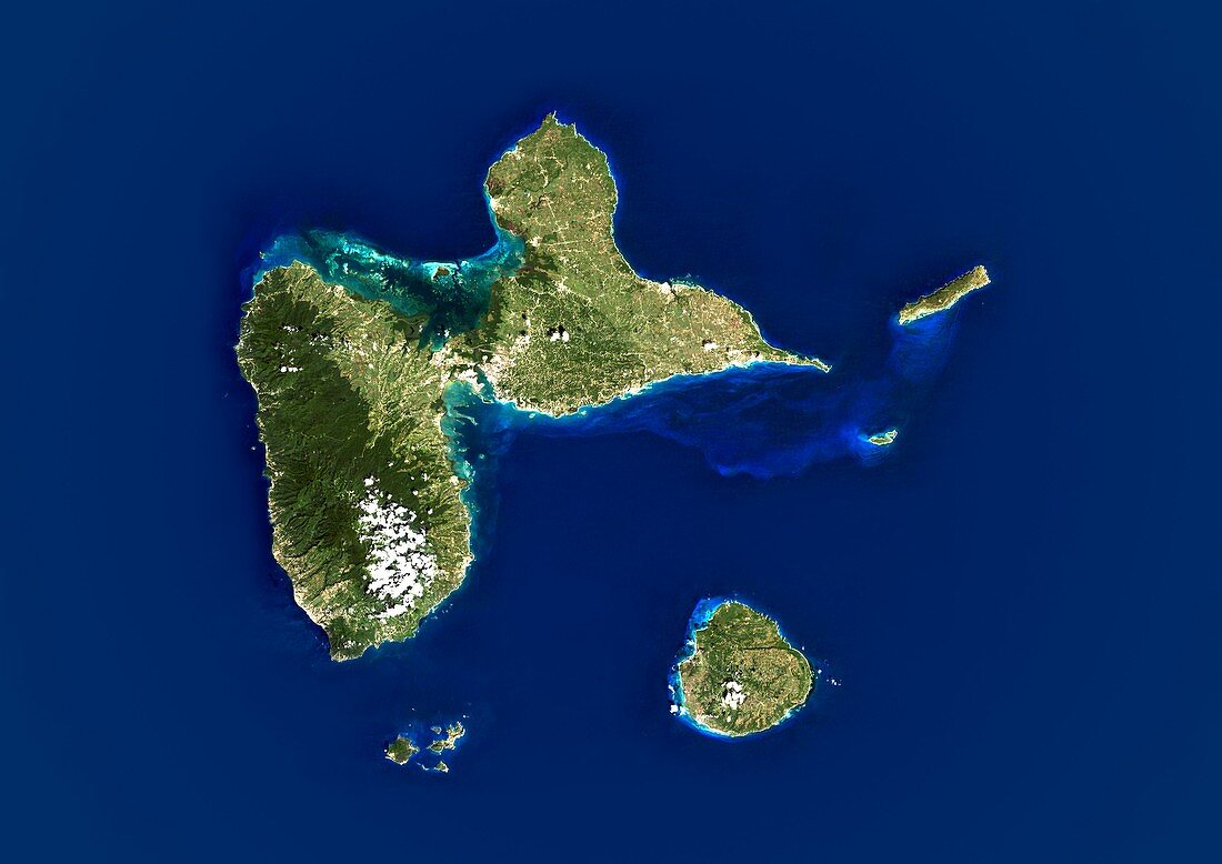
| Guadeloupe,satellite image. North is at top. Water is blue,vegetation is green,clouds are white,and shallow coastal areas are light blue. Guadeloupe is an archipelago of five islands in the eastern Caribbean Sea. The largest are Basse-Terre and Grande-Terre islands,which together form a butterfly shape around 60 kilometres across. The island at lower right is Marie-Galante. Image data obtained by the Landsat 5 and Landsat 7 satellites | |
| Lizenzart: | Lizenzpflichtig |
| Credit: | Science Photo Library / Planetobserver |
| Bildgröße: | 4978 px × 3520 px |
| Modell-Rechte: | nicht erforderlich |
| Eigentums-Rechte: | nicht erforderlich |
| Restrictions: | - |
Preise für dieses Bild ab 15 €
Universitäten & Organisationen
(Informationsmaterial Digital, Informationsmaterial Print, Lehrmaterial Digital etc.)
ab 15 €
Redaktionell
(Bücher, Bücher: Sach- und Fachliteratur, Digitale Medien (redaktionell) etc.)
ab 30 €
Werbung
(Anzeigen, Aussenwerbung, Digitale Medien, Fernsehwerbung, Karten, Werbemittel, Zeitschriften etc.)
ab 55 €
Handelsprodukte
(bedruckte Textilie, Kalender, Postkarte, Grußkarte, Verpackung etc.)
ab 75 €
Pauschalpreise
Rechtepakete für die unbeschränkte Bildnutzung in Print oder Online
ab 495 €
Keywords
- Archipel,
- Erdbeobachtung,
- Französisch,
- geografisch,
- Geographie,
- Geowissenschaften,
- Grenzen,
- Guadeloupe,
- Insel,
- Inseln,
- Karibik,
- Karibisches Meer,
- Kartographie,
- Küste,
- Küsten-,
- Küstenlinie,
- Land,
- Landsat 7,
- Meer,
- Nation,
- Nordamerika,
- nordamerikanisch,
- Ozean,
- Rand,
- Satellit,
- Satellitenbild,
- Topographie,
- Umwelt,
- Wasser,
- Weltall,
- Westindische Inseln