The Philippines,satellite image
Bildnummer 11564054
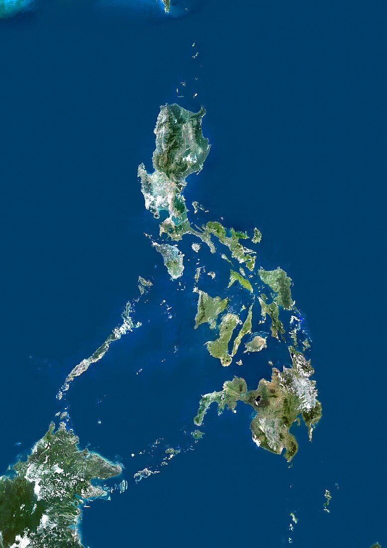
| The Philippines,satellite image. North is at top. Water is blue,vegetation is green,and clouds and snow and ice are white. Shallow coastal areas are light blue. The Philippines,an archipelago of over 7000 islands in the Western Pacific,stretches 1850 kilometres from south to north. The largest islands are Luzon (upper centre) and Mindanao (lower right). Image data obtained by the Landsat 5 and Landsat 7 satellites | |
| Lizenzart: | Lizenzpflichtig |
| Credit: | Science Photo Library / Planetobserver |
| Bildgröße: | 3520 px × 4978 px |
| Modell-Rechte: | nicht erforderlich |
| Eigentums-Rechte: | nicht erforderlich |
| Restrictions: | - |
Preise für dieses Bild ab 15 €
Universitäten & Organisationen
(Informationsmaterial Digital, Informationsmaterial Print, Lehrmaterial Digital etc.)
ab 15 €
Redaktionell
(Bücher, Bücher: Sach- und Fachliteratur, Digitale Medien (redaktionell) etc.)
ab 30 €
Werbung
(Anzeigen, Aussenwerbung, Digitale Medien, Fernsehwerbung, Karten, Werbemittel, Zeitschriften etc.)
ab 55 €
Handelsprodukte
(bedruckte Textilie, Kalender, Postkarte, Grußkarte, Verpackung etc.)
ab 75 €
Pauschalpreise
Rechtepakete für die unbeschränkte Bildnutzung in Print oder Online
ab 495 €
Keywords
- Archipel,
- Asiatisch,
- Asien,
- Erdbeobachtung,
- geografisch,
- Geographie,
- Geowissenschaften,
- Grenzen,
- Insel,
- Inseln,
- Kartographie,
- Küste,
- Küsten-,
- Küstenlinie,
- Land,
- Landsat 7,
- Maritim,
- Meer,
- Mindanao,
- Nation,
- Ozean,
- ozeanisch,
- Pazifik,
- Philippinen,
- Rand,
- Satellit,
- Satellitenbild,
- Topographie,
- Umwelt,
- Wasser,
- Weltall