Malta,satellite image
Bildnummer 11563970
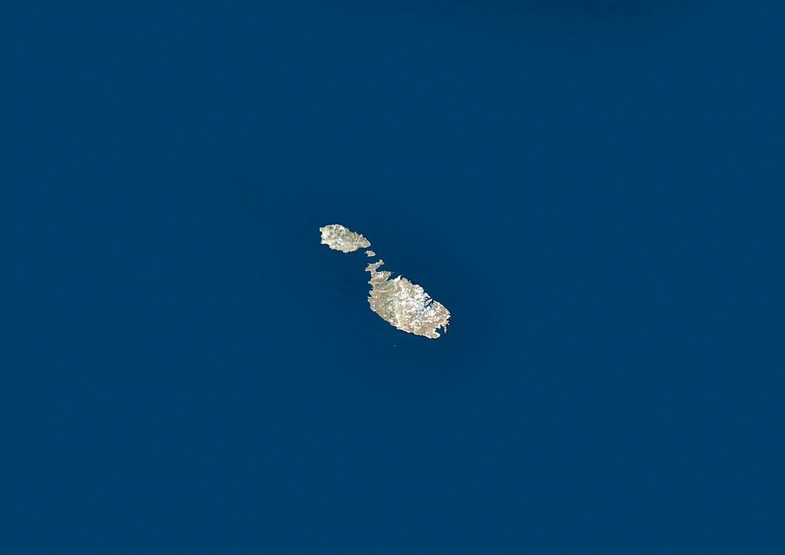
| Malta,satellite image. North is at top. Water is blue,vegetation is brown and green and developed areas are grey/white. The Republic of Malta is an archipelago in the Mediterranean Sea. The two largest islands are Malta (lower right) and Gozo (upper left). Malta's capital and main port is Valletta (grey/white) situated around two inlets on Malta's northern coastline. The main island of Malta is about 15 kilometres long. Image data obtained by the Landsat 5 and Landsat 7 satellites | |
| Lizenzart: | Lizenzpflichtig |
| Credit: | Science Photo Library / Planetobserver |
| Bildgröße: | 4978 px × 3520 px |
| Modell-Rechte: | nicht erforderlich |
| Eigentums-Rechte: | nicht erforderlich |
| Restrictions: | - |
Preise für dieses Bild ab 15 €
Universitäten & Organisationen
(Informationsmaterial Digital, Informationsmaterial Print, Lehrmaterial Digital etc.)
ab 15 €
Redaktionell
(Bücher, Bücher: Sach- und Fachliteratur, Digitale Medien (redaktionell) etc.)
ab 30 €
Werbung
(Anzeigen, Aussenwerbung, Digitale Medien, Fernsehwerbung, Karten, Werbemittel, Zeitschriften etc.)
ab 55 €
Handelsprodukte
(bedruckte Textilie, Kalender, Postkarte, Grußkarte, Verpackung etc.)
ab 75 €
Pauschalpreise
Rechtepakete für die unbeschränkte Bildnutzung in Print oder Online
ab 495 €
Keywords
- Archipel,
- ausgeschnitten,
- Ausschnitte,
- Erdbeobachtung,
- Europa,
- europäisch,
- geografisch,
- Geographie,
- Geowissenschaften,
- Gozo,
- Grenzen,
- Insel,
- Inseln,
- Kartographie,
- Küste,
- Küsten-,
- Küstenlinie,
- Land,
- Landsat 7,
- Malta,
- Meer,
- Mittelmeer,
- Nation,
- Ozean,
- Rand,
- Satellit,
- Satellitenbild,
- Topographie,
- Umwelt,
- Wasser,
- Weltall