Richat structure,3-D satellite image
Bildnummer 11562091
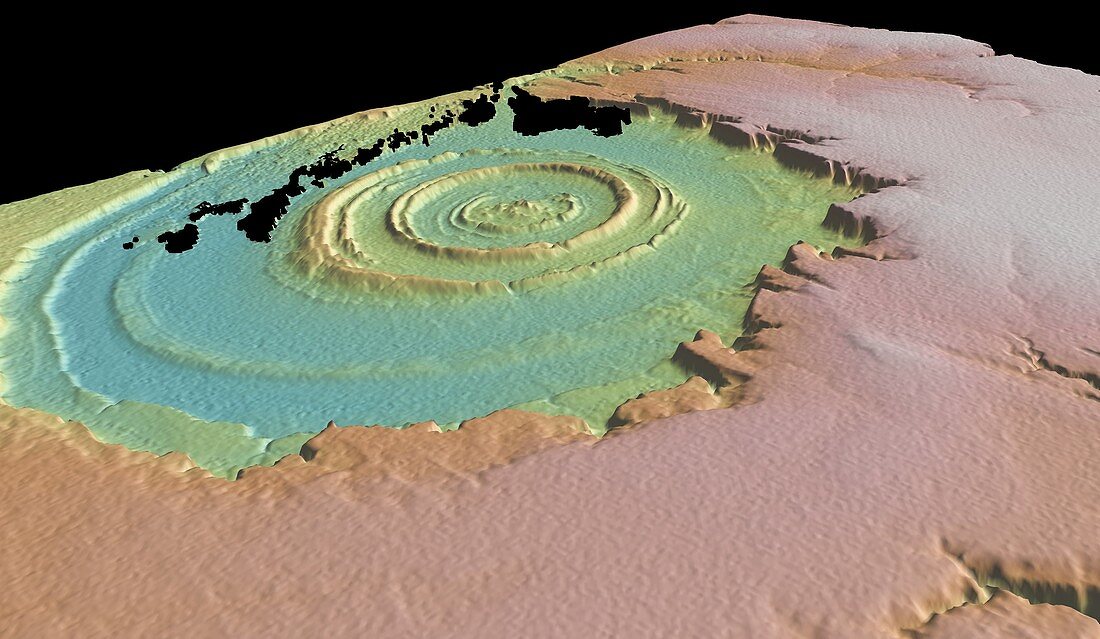
| Richat structure. 3-D satellite image of the Richat structure,Maur Adrar Desert,central Mauritania,Africa. It was produced using GeoMapApp,a geophysical visualisation program at the Lamont-Doherty Earth Observatory of Columbia University,USA,using data from the Shuttle Radar Topographic Mission (SRTM). This bullseye structure is almost 50 kilometres in diameter and,contrary to its appearance,is not an impact crater but is most probably a natural rock formation | |
| Lizenzart: | Lizenzpflichtig |
| Credit: | Science Photo Library / GEOMAPAPP / RYAN ET AL |
| Bildgröße: | 5162 px × 3000 px |
| Modell-Rechte: | nicht erforderlich |
| Eigentums-Rechte: | nicht erforderlich |
| Restrictions: | - |
Preise für dieses Bild ab 15 €
Universitäten & Organisationen
(Informationsmaterial Digital, Informationsmaterial Print, Lehrmaterial Digital etc.)
ab 15 €
Redaktionell
(Bücher, Bücher: Sach- und Fachliteratur, Digitale Medien (redaktionell) etc.)
ab 30 €
Werbung
(Anzeigen, Aussenwerbung, Digitale Medien, Fernsehwerbung, Karten, Werbemittel, Zeitschriften etc.)
ab 55 €
Handelsprodukte
(bedruckte Textilie, Kalender, Postkarte, Grußkarte, Verpackung etc.)
ab 75 €
Pauschalpreise
Rechtepakete für die unbeschränkte Bildnutzung in Print oder Online
ab 495 €