Mount Pinatubo eruption,particle model
Bildnummer 11558512
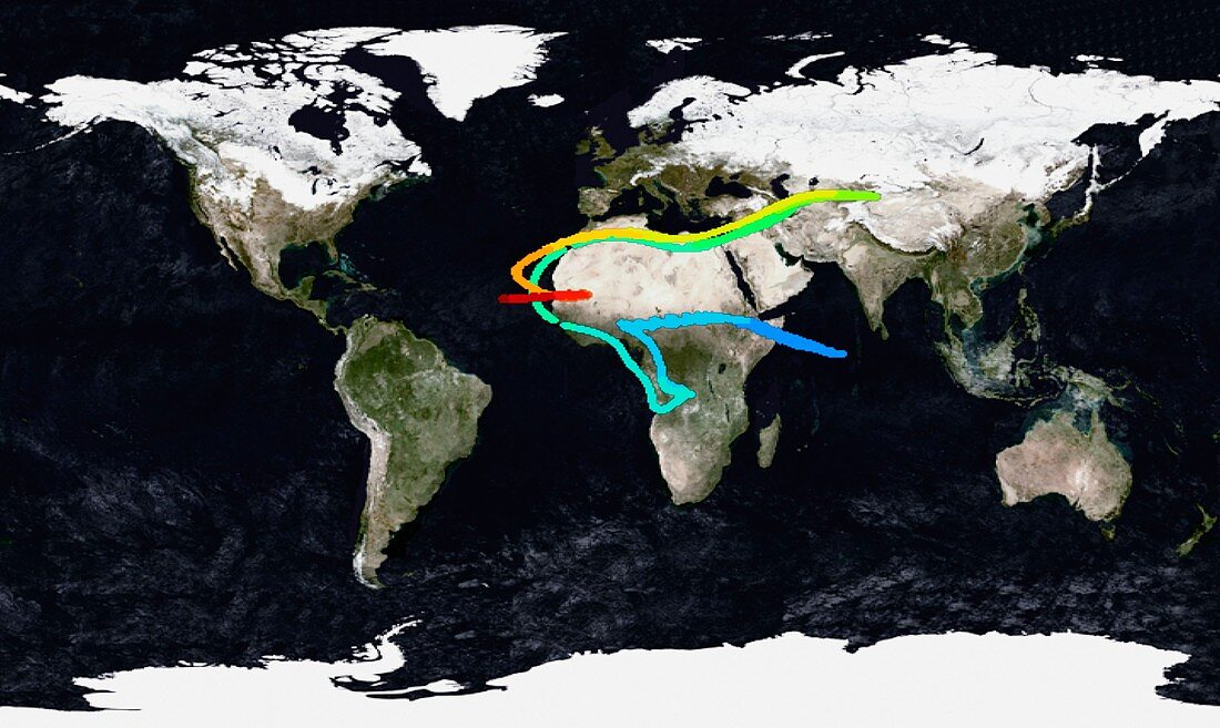
| Mount Pinatubo eruption,particle model. Image 3 of 8. Satellite map of the Earth showing the spread through the atmosphere of particles from the eruption of Mount Pinatubo,in the Philippines,on 15 June 1991. This image shows the particle distribution on 23 June 1991. The colours show the atmospheric height of the dust particles,from red (highest) through orange,yellow and green to blue (lowest). The sulphur dioxide and dust particles produced by this eruption caused a drop in global temperatures over the following months | |
| Lizenzart: | Lizenzpflichtig |
| Credit: | Science Photo Library / GSFC-SVS / NASA |
| Bildgröße: | 5422 px × 3236 px |
| Modell-Rechte: | nicht erforderlich |
| Eigentums-Rechte: | nicht erforderlich |
| Restrictions: | - |
Preise für dieses Bild ab 15 €
Universitäten & Organisationen
(Informationsmaterial Digital, Informationsmaterial Print, Lehrmaterial Digital etc.)
ab 15 €
Redaktionell
(Bücher, Bücher: Sach- und Fachliteratur, Digitale Medien (redaktionell) etc.)
ab 30 €
Werbung
(Anzeigen, Aussenwerbung, Digitale Medien, Fernsehwerbung, Karten, Werbemittel, Zeitschriften etc.)
ab 55 €
Handelsprodukte
(bedruckte Textilie, Kalender, Postkarte, Grußkarte, Verpackung etc.)
ab 75 €
Pauschalpreise
Rechtepakete für die unbeschränkte Bildnutzung in Print oder Online
ab 495 €
Keywords
- 1900er Jahre,
- 1990er Jahre,
- 20. Jahrhundert,
- atmosphärisch,
- Ausbreitung,
- Distribution,
- Erde,
- Eruption,
- geografisch,
- Geographie,
- Juni,
- Karte,
- Klimawandel,
- Kreislauf,
- Meteorologie,
- meteorologisch,
- Modell-,
- Philippinen,
- Planet,
- Reihenfolge,
- Satellit,
- Schwefel,
- Serie,
- Spur,
- Umweltwissenschaften,
- Verbreitung,
- Verfolgung,
- vulkanisch,
- Vulkanologie,
- weltweit,
- Wetter