Pine Island Glacier,satellite image
Bildnummer 11558296
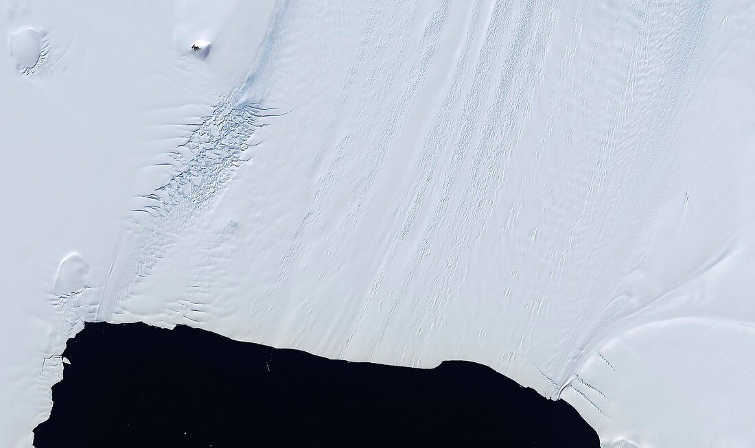
| Pine Island Glacier. Satellite image of the Pine Island Glacier on the Antarctic coast. Towards upper left is an area of deep crevasses (near horizontal lines),which indicate that part of the glacier is moving rapidly. In the past,as the crevasses have moved nearer to the coast,they have led to the calving of huge ice bergs from the glacier. Pine Island bay is at bottom centre. Image from the Landsat image mosaic of Antarctica (LIMA) | |
| Lizenzart: | Lizenzpflichtig |
| Credit: | Science Photo Library / NASA |
| Bildgröße: | 3850 px × 2287 px |
| Modell-Rechte: | nicht erforderlich |
| Eigentums-Rechte: | nicht erforderlich |
| Restrictions: | - |
Preise für dieses Bild ab 15 €
Universitäten & Organisationen
(Informationsmaterial Digital, Informationsmaterial Print, Lehrmaterial Digital etc.)
ab 15 €
Redaktionell
(Bücher, Bücher: Sach- und Fachliteratur, Digitale Medien (redaktionell) etc.)
ab 30 €
Werbung
(Anzeigen, Aussenwerbung, Digitale Medien, Fernsehwerbung, Karten, Werbemittel, Zeitschriften etc.)
ab 55 €
Handelsprodukte
(bedruckte Textilie, Kalender, Postkarte, Grußkarte, Verpackung etc.)
ab 75 €
Pauschalpreise
Rechtepakete für die unbeschränkte Bildnutzung in Print oder Online
ab 495 €