Whole Earth at night,satellite image
Bildnummer 11555561
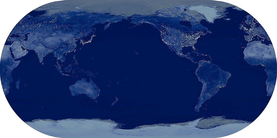
| Whole Earth at night,satellite image. This map is centred on the Pacific Ocean,at longitude 140 degrees west. City lights (yellow) show areas of dense population,and areas of few lights are more sparsely populated. This image was produced by combining data from the Defense Meteorological Satellite Program (DMSP) and NOAA's POES satellites | |
| Lizenzart: | Lizenzpflichtig |
| Credit: | Science Photo Library / Planetary Visions |
| Bildgröße: | 5938 px × 2958 px |
| Modell-Rechte: | nicht erforderlich |
| Eigentums-Rechte: | nicht erforderlich |
| Restrictions: | - |
Preise für dieses Bild ab 15 €
Universitäten & Organisationen
(Informationsmaterial Digital, Informationsmaterial Print, Lehrmaterial Digital etc.)
ab 15 €
Redaktionell
(Bücher, Bücher: Sach- und Fachliteratur, Digitale Medien (redaktionell) etc.)
ab 30 €
Werbung
(Anzeigen, Aussenwerbung, Digitale Medien, Fernsehwerbung, Karten, Werbemittel, Zeitschriften etc.)
ab 55 €
Handelsprodukte
(bedruckte Textilie, Kalender, Postkarte, Grußkarte, Verpackung etc.)
ab 75 €
Pauschalpreise
Rechtepakete für die unbeschränkte Bildnutzung in Print oder Online
ab 495 €
Keywords
- 21. Jahrhundert,
- bewohnt,
- dicht besiedelt,
- Dichte,
- Distribution,
- DMSP,
- Dunkel,
- Dunkelheit,
- Eckert iii Projektion,
- Energie,
- Erdbeobachtung,
- Erde,
- Erdkunde,
- ganze Erde,
- geografisch,
- Geographie,
- Globus,
- kombinierte Daten,
- Kontinent,
- Kontinente,
- Leistung,
- Licht,
- Lichter,
- Menschliche Bevölkerung,
- menschliche Geografie,
- Nacht,
- Nachtzeit,
- NOAA,
- Pazifik,
- Person,
- Planet,
- POES,
- Raum,
- Satellit,
- Satellitenbild,
- Stadt,
- Städte,
- Stadtgeographie,
- städtisch,
- Technologie,
- technologisch,
- Umwelt,
- Unbewohnt,
- Urbanisierung,
- Welt,
- Weltall