Asia,topographic map
Bildnummer 11555528
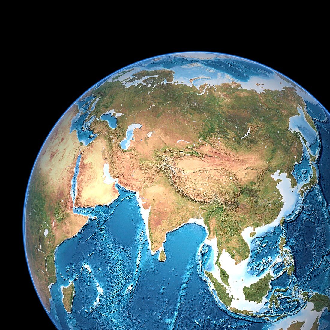
| Asia,topographic map. Highlands and lowlands of the continents are shown as ridges and flat areas. Europe (upper left),East Asia (upper right),Southeast Asia (lower right),India (lower centre) and Africa (left) are also seen. The seabed depth varies from shallow (light blue) on the continental shelves to deep ocean basins (dark blue). Topographic and bathymetric data is usually gathered by using aerial and satellite imagery combined with radar and sonar mapping. The satellites in this case were NOAA's POES satellites | |
| Lizenzart: | Lizenzpflichtig |
| Credit: | Science Photo Library / Planetary Visions |
| Bildgröße: | 4193 px × 4193 px |
| Modell-Rechte: | nicht erforderlich |
| Eigentums-Rechte: | nicht erforderlich |
| Restrictions: | - |
Preise für dieses Bild ab 15 €
Universitäten & Organisationen
(Informationsmaterial Digital, Informationsmaterial Print, Lehrmaterial Digital etc.)
ab 15 €
Redaktionell
(Bücher, Bücher: Sach- und Fachliteratur, Digitale Medien (redaktionell) etc.)
ab 30 €
Werbung
(Anzeigen, Aussenwerbung, Digitale Medien, Fernsehwerbung, Karten, Werbemittel, Zeitschriften etc.)
ab 55 €
Handelsprodukte
(bedruckte Textilie, Kalender, Postkarte, Grußkarte, Verpackung etc.)
ab 75 €
Pauschalpreise
Rechtepakete für die unbeschränkte Bildnutzung in Print oder Online
ab 495 €
Keywords
- abgebildet,
- Altimetrie,
- altimetrisch,
- Asien,
- Bathymetrie,
- bathymetrisch,
- Becken,
- Berge,
- China,
- Erde,
- Europa,
- geografisch,
- Geographie,
- Globus,
- Grat,
- Indien,
- Indischer Ozean,
- Indonesien,
- Insel,
- Inseln,
- Japan,
- Karte,
- kombinierte Daten,
- Kontinent,
- Kreis,
- Kugel,
- kugelförmig,
- Land,
- Malaysia,
- Marine,
- Meer,
- Meeresboden,
- Meereskunde,
- Mittlerer Osten,
- Modell-,
- neunzig Ostgrat,
- NOAA,
- Ostasien,
- Ozean,
- ozeanisch,
- Pazifik,
- Philippinen,
- Planet,
- POES,
- Regale,
- Region,
- rund,
- Satellit,
- Satellitenbild,
- Südostasien,
- Tiefe,
- topografisch,
- Topographie,
- Welt