Southern Norway,satellite radar image
Bildnummer 11553079
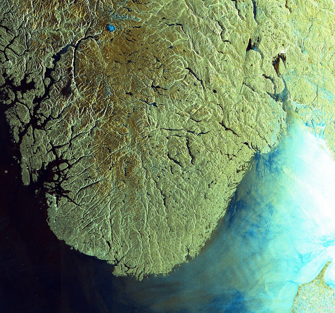
| Southern Norway,satellite radar image. North is at top. This image covers the area of Sorlandet (Southern Norway). The terrain is mountainous inland,with a populated coastal strip along the Skagerrak Strait (lower right). The dark brown area inland at upper left is the Hardangervidda National Park. In the strait are shallows,reefs and sand banks. Part of Denmark is at bottom right. This image was obtained in 2003 by the ASAR (Advanced Synthetic Aperture Radar) instrument on ESA's Envisat (Environmental Satellite) | |
| Lizenzart: | Lizenzpflichtig |
| Credit: | Science Photo Library / ESA |
| Bildgröße: | 5004 px × 4670 px |
| Modell-Rechte: | nicht erforderlich |
| Eigentums-Rechte: | nicht erforderlich |
| Restrictions: |
|
Preise für dieses Bild ab 15 €
Universitäten & Organisationen
(Informationsmaterial Digital, Informationsmaterial Print, Lehrmaterial Digital etc.)
ab 15 €
Redaktionell
(Bücher, Bücher: Sach- und Fachliteratur, Digitale Medien (redaktionell) etc.)
ab 30 €
Werbung
(Anzeigen, Aussenwerbung, Digitale Medien, Fernsehwerbung, Karten, Werbemittel, Zeitschriften etc.)
ab 55 €
Handelsprodukte
(bedruckte Textilie, Kalender, Postkarte, Grußkarte, Verpackung etc.)
ab 75 €
Pauschalpreise
Rechtepakete für die unbeschränkte Bildnutzung in Print oder Online
ab 495 €
Keywords
- 21. Jahrhundert,
- Atlantischer Ozean,
- Berg,
- Berge,
- bergig,
- Erdbeobachtung,
- esa,
- Europa,
- europäisch,
- Europäische Weltraumbehörde,
- Fjord,
- Fjorde,
- gebirgig,
- geografisch,
- Geographie,
- Küste,
- Küsten-,
- Küstenlinie,
- Land,
- Marine,
- Maritim,
- Meer,
- montan,
- Nordsee,
- Norwegen,
- Norwegisch,
- Oslo,
- Riff,
- Sandbank,
- Satellit,
- Satellitenbild,
- Skandinavien,
- Skandinavisch,
- Wasser,
- Weltall