Flinders Ranges,satellite image
Bildnummer 11688676
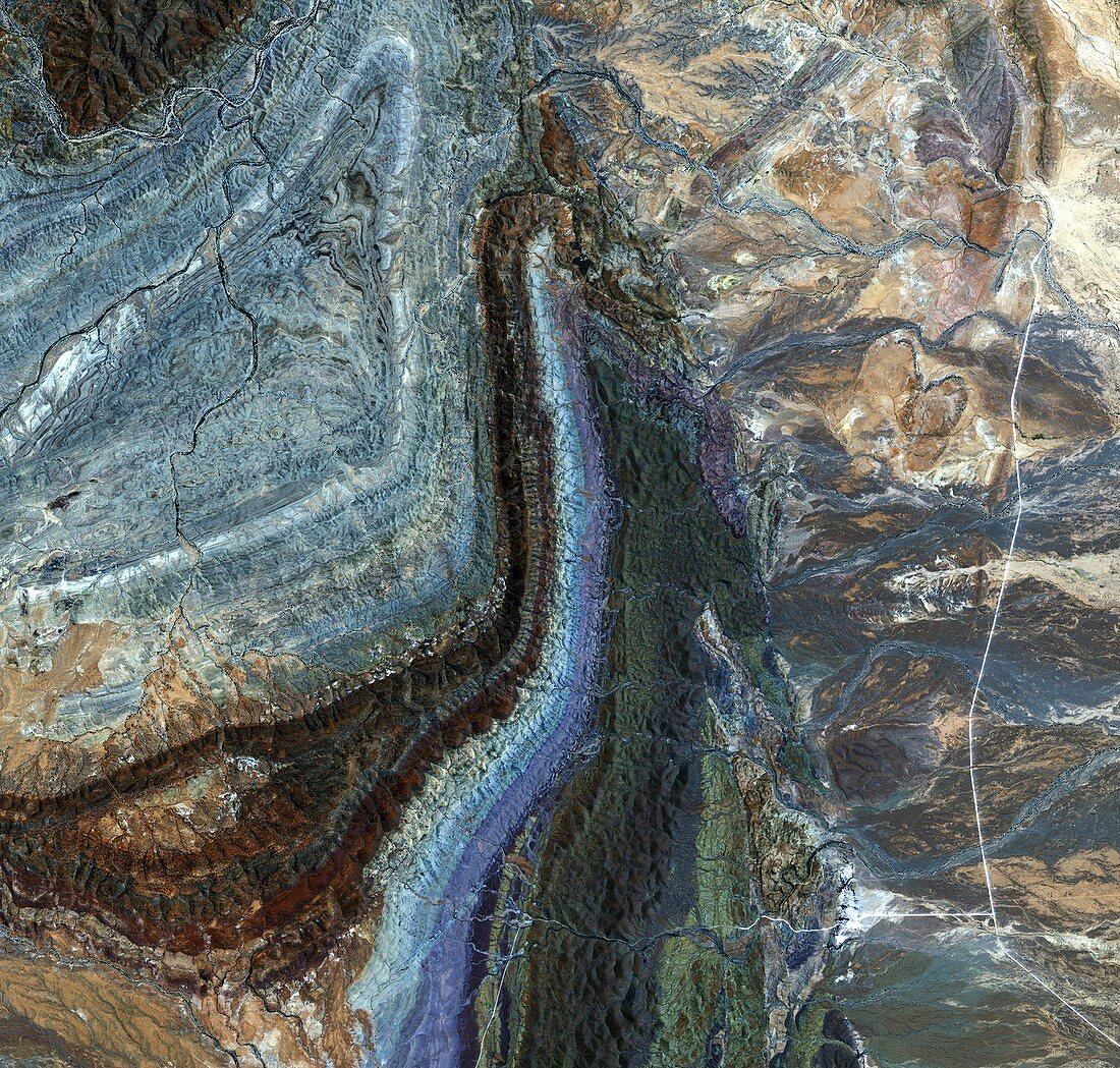
| Satellite image of the Flinders Ranges in South Australia. This area is part of a larger geosyncline,a linear trough that has subsided beneath accumulating sediments. Different colours relate to different rock layers. Running up centre is a long narrow gorge. Image obtained by Japan's ALOS satellite on 3rd January 2009 | |
| Lizenzart: | Lizenzpflichtig |
| Credit: | Science Photo Library / ESA / JAXA |
| Bildgröße: | 2604 px × 2484 px |
| Modell-Rechte: | nicht erforderlich |
| Eigentums-Rechte: | nicht erforderlich |
| Restrictions: |
|
Preise für dieses Bild ab 15 €
Universitäten & Organisationen
(Informationsmaterial Digital, Informationsmaterial Print, Lehrmaterial Digital etc.)
ab 15 €
Redaktionell
(Bücher, Bücher: Sach- und Fachliteratur, Digitale Medien (redaktionell) etc.)
ab 30 €
Werbung
(Anzeigen, Aussenwerbung, Digitale Medien, Fernsehwerbung, Karten, Werbemittel, Zeitschriften etc.)
ab 55 €
Handelsprodukte
(bedruckte Textilie, Kalender, Postkarte, Grußkarte, Verpackung etc.)
ab 75 €
Pauschalpreise
Rechtepakete für die unbeschränkte Bildnutzung in Print oder Online
ab 495 €