Betsiboka estuary,Madagascar
Bildnummer 11626917
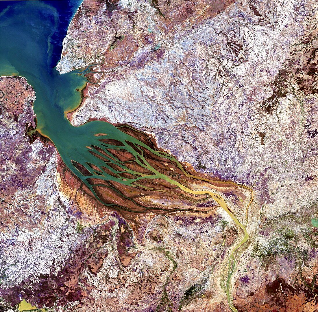
| Betsiboka estuary,Madagascar,satellite image. This bay links the Betsiboka River (at right) with the Mozambique Channel (top left),part of the Indian Ocean. The river carries a large amount of sediment,which has led to the development of several silt islands. The heavy sediment load is largely due to deforestation along the river's banks to make way for agriculture. Crops including rice and coffee are extensively grown in the area. This image,was taken by the Japan's ALOS satellite on 17th September 2010 | |
| Lizenzart: | Lizenzpflichtig |
| Credit: | Science Photo Library / ESA / JAXA |
| Bildgröße: | 4252 px × 4166 px |
| Modell-Rechte: | nicht erforderlich |
| Eigentums-Rechte: | nicht erforderlich |
| Restrictions: |
|
Preise für dieses Bild ab 15 €
Universitäten & Organisationen
(Informationsmaterial Digital, Informationsmaterial Print, Lehrmaterial Digital etc.)
ab 15 €
Redaktionell
(Bücher, Bücher: Sach- und Fachliteratur, Digitale Medien (redaktionell) etc.)
ab 30 €
Werbung
(Anzeigen, Aussenwerbung, Digitale Medien, Fernsehwerbung, Karten, Werbemittel, Zeitschriften etc.)
ab 55 €
Handelsprodukte
(bedruckte Textilie, Kalender, Postkarte, Grußkarte, Verpackung etc.)
ab 75 €
Pauschalpreise
Rechtepakete für die unbeschränkte Bildnutzung in Print oder Online
ab 495 €