St.Kilda
Bildnummer 11674004
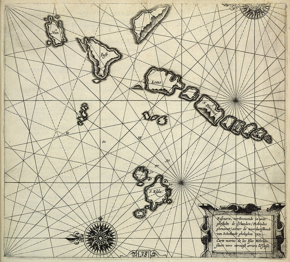
| St.Kilda Chart showing St.Kilda and other islands. Image taken from The Light of Navigation,wherein are declared and lively pourtrayed,all the Coasts and Havens,of the West,North and East Seas By William Johnson i.e. Willem Janszoon Blaeu. Translated from Het Licht der Zee-vaert. (The first book. pp. 114,and charts 1-6,8-19. The second book. pp. 118,and charts 20-41). 270 x 280 mm. Originally published in Amsterdam : Jean Jeansson,1620 | |
| Lizenzart: | Lizenzpflichtig |
| Credit: | Science Photo Library / British Library |
| Bildgröße: | 4401 px × 3971 px |
| Modell-Rechte: | nicht erforderlich |
| Eigentums-Rechte: | nicht erforderlich |
| Restrictions: | - |
Preise für dieses Bild ab 15 €
Universitäten & Organisationen
(Informationsmaterial Digital, Informationsmaterial Print, Lehrmaterial Digital etc.)
ab 15 €
Redaktionell
(Bücher, Bücher: Sach- und Fachliteratur, Digitale Medien (redaktionell) etc.)
ab 30 €
Werbung
(Anzeigen, Aussenwerbung, Digitale Medien, Fernsehwerbung, Karten, Werbemittel, Zeitschriften etc.)
ab 55 €
Handelsprodukte
(bedruckte Textilie, Kalender, Postkarte, Grußkarte, Verpackung etc.)
ab 75 €
Pauschalpreise
Rechtepakete für die unbeschränkte Bildnutzung in Print oder Online
ab 495 €