Danebury Camp, Hampshire, 3D LiDAR scan
Bildnummer 14179765
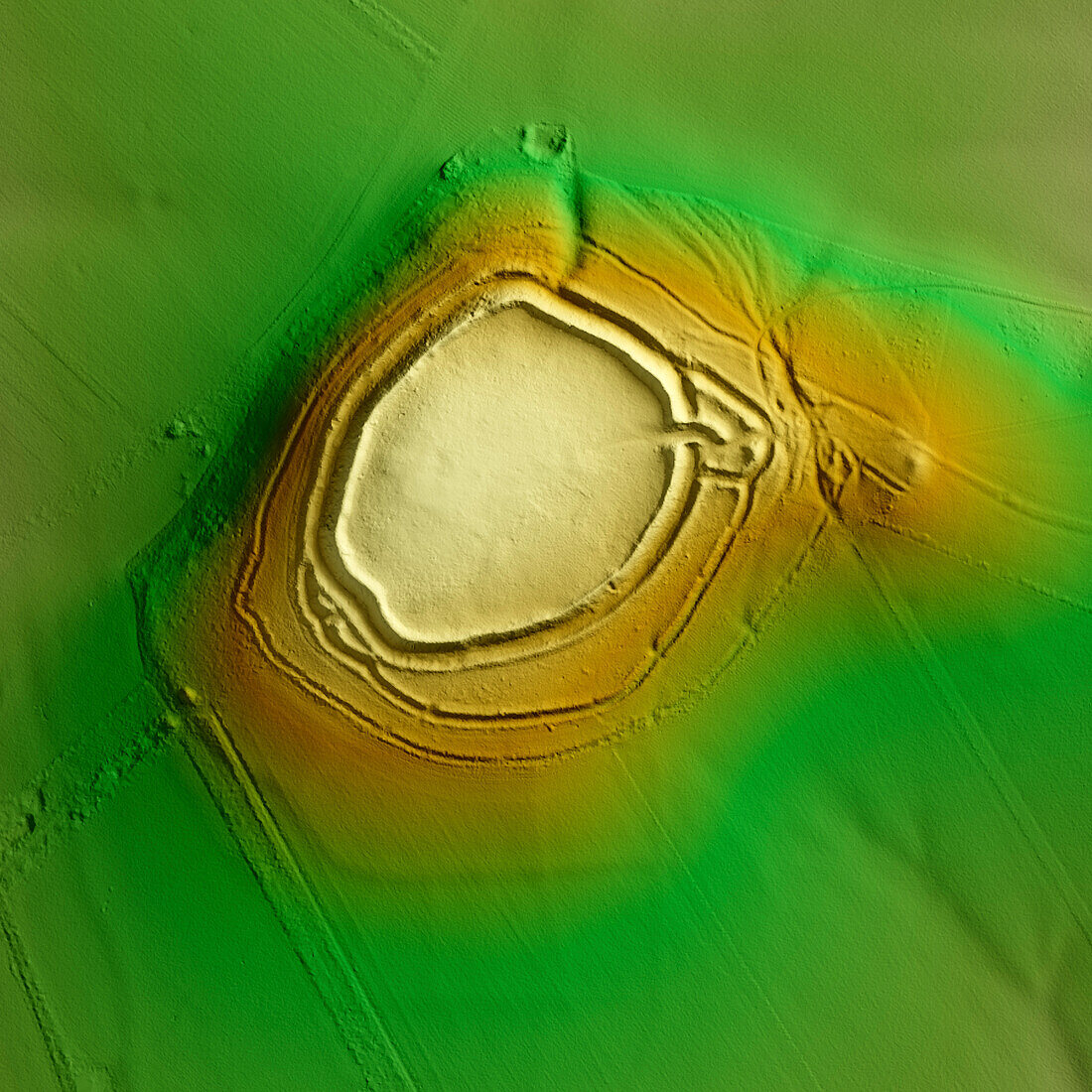
| 3D LiDAR model of Danebury Camp, an Iron Age hillfort in Hampshire, UK. The digital terrain model offers a view of the surrounding landscape without obstruction from foliage. Hillforts were settlements constructed on natural hills, typically fortified with earthworks around the contours of the hill. They were widely constructed across Britain and Ireland in the centuries preceding the Roman conquest of the regions. Evidence found suggests that the fort was built 2500 years ago and occupied for nearly 500 years until the arrival of the Romans. Image contains UK public sector information licensed under the Open Government Licence v3.0. | |
| Lizenzart: | Lizenzpflichtig |
| Credit: | Science Photo Library / Terrey, Simon |
| Bildgröße: | 5905 px × 5905 px |
| Modell-Rechte: | nicht erforderlich |
| Eigentums-Rechte: | nicht erforderlich |
| Restrictions: | - |
Preise für dieses Bild ab 15 €
Universitäten & Organisationen
(Informationsmaterial Digital, Informationsmaterial Print, Lehrmaterial Digital etc.)
ab 15 €
Redaktionell
(Bücher, Bücher: Sach- und Fachliteratur, Digitale Medien (redaktionell) etc.)
ab 30 €
Werbung
(Anzeigen, Aussenwerbung, Digitale Medien, Fernsehwerbung, Karten, Werbemittel, Zeitschriften etc.)
ab 55 €
Handelsprodukte
(bedruckte Textilie, Kalender, Postkarte, Grußkarte, Verpackung etc.)
ab 75 €
Pauschalpreise
Rechtepakete für die unbeschränkte Bildnutzung in Print oder Online
ab 495 €
Keywords
- 3D,
- Alt,
- Alter,
- Archäologie,
- archäologisch,
- Aussicht,
- britisch,
- Defensive,
- Digitales Geländemodell,
- dtm,
- England,
- Englisch,
- Europa,
- europäisch,
- Geschichte,
- Großbritannien,
- Hampshire,
- historisch,
- Hügel,
- Landschaft,
- Laser,
- Modell-,
- Modelling,
- Niemand,
- prähistorisch,
- Scan,
- Siedlung,
- Terrain,
- topografisch,
- Topographie,
- topographisch,
- Vereinigtes Königreich,
- Verteidigung,
- Vorgeschichte