Hurricane Matthew, satellite image
Bildnummer 13524617
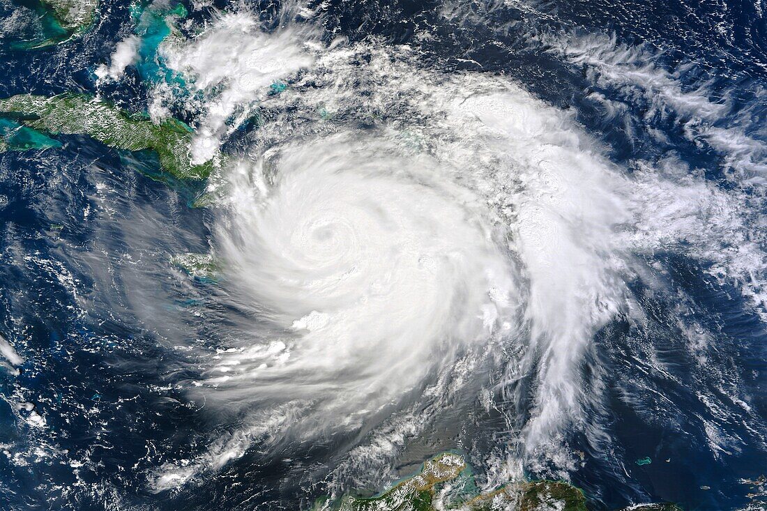
| Satellite image of Hurricane Matthew over Haiti on the 4th of October 2016. Matthew reached Haiti as a Category 4 Hurricane with winds of 241 kilometres per hour. The hurricane was the strongest storm to hit Haiti in over 50 years, causing catastrophic damage and loss of life. Data obtained by the Moderate Resolution Imaging Spectroradiometer (MODIS) on NASA's Terra satellite. | |
| Lizenzart: | Lizenzpflichtig |
| Credit: | Science Photo Library / NASA |
| Bildgröße: | 5119 px × 3412 px |
| Modell-Rechte: | nicht erforderlich |
| Eigentums-Rechte: | nicht erforderlich |
| Restrictions: | - |
Preise für dieses Bild ab 15 €
Universitäten & Organisationen
(Informationsmaterial Digital, Informationsmaterial Print, Lehrmaterial Digital etc.)
ab 15 €
Redaktionell
(Bücher, Bücher: Sach- und Fachliteratur, Digitale Medien (redaktionell) etc.)
ab 30 €
Werbung
(Anzeigen, Aussenwerbung, Digitale Medien, Fernsehwerbung, Karten, Werbemittel, Zeitschriften etc.)
ab 55 €
Handelsprodukte
(bedruckte Textilie, Kalender, Postkarte, Grußkarte, Verpackung etc.)
ab 75 €
Pauschalpreise
Rechtepakete für die unbeschränkte Bildnutzung in Print oder Online
ab 495 €