Vegetation zones on map of Canada, illustration
Bildnummer 13497049
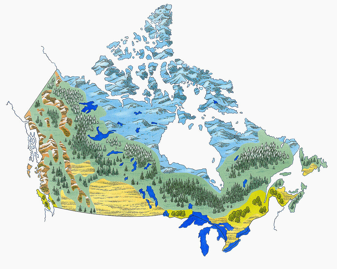
| Illustration of vegetation zones on map of Canada including arctic, subarctic, barren land, tundra, forest, cropland, rangeland and pasture. | |
| Lizenzart: | Lizenzpflichtig |
| Credit: | Science Photo Library / DK IMAGES |
| Bildgröße: | 4580 px × 3660 px |
| Modell-Rechte: | nicht erforderlich |
| Eigentums-Rechte: | nicht erforderlich |
| Restrictions: | - |
Preise für dieses Bild ab 15 €
Universitäten & Organisationen
(Informationsmaterial Digital, Informationsmaterial Print, Lehrmaterial Digital etc.)
ab 15 €
Redaktionell
(Bücher, Bücher: Sach- und Fachliteratur, Digitale Medien (redaktionell) etc.)
ab 30 €
Werbung
(Anzeigen, Aussenwerbung, Digitale Medien, Fernsehwerbung, Karten, Werbemittel, Zeitschriften etc.)
ab 55 €
Handelsprodukte
(bedruckte Textilie, Kalender, Postkarte, Grußkarte, Verpackung etc.)
ab 75 €
Pauschalpreise
Rechtepakete für die unbeschränkte Bildnutzung in Print oder Online
ab 495 €
Keywords
- 1,
- Abwesenheit,
- Arktis,
- direkt darüber,
- draußen,
- Eis,
- Fülle,
- Gemischt,
- Illustration,
- Kalt,
- Kanada,
- Kanadisch,
- Karte,
- Klima,
- Kontraste,
- Kunstwerk,
- Landschaft,
- Landwirtschaft,
- Natur,
- Niemand,
- Nordamerika,
- nordamerikanisch,
- See,
- Tag,
- Temperatur,
- Tundra,
- unfruchtbar,
- Üppig,
- Variation,
- Vegetation,
- Wachstum,
- Wald,
- Weide,
- weißer Hintergrund,
- Winter,
- zapfentragend,
- Zone