Mont Blanc, France, satellite image
Bildnummer 13404620
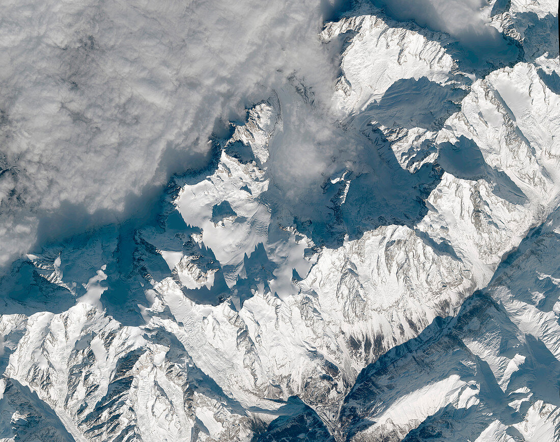
| Satellite image of Mont Blanc situated in the French Alps. At 4808 metres, Mont Blanc is the tallest mountain in the Alps. It lies on the border between France and Italy and was first climbed in 1786. Image obtained by a Pleiades satellite on 17 December 2020. | |
| Lizenzart: | Lizenzpflichtig |
| Credit: | Science Photo Library / AIRBUS DEFENCE AND SPACE |
| Bildgröße: | 5012 px × 3956 px |
| Modell-Rechte: | nicht erforderlich |
| Eigentums-Rechte: | nicht erforderlich |
| Restrictions: | - |
Preise für dieses Bild ab 15 €
Universitäten & Organisationen
(Informationsmaterial Digital, Informationsmaterial Print, Lehrmaterial Digital etc.)
ab 15 €
Redaktionell
(Bücher, Bücher: Sach- und Fachliteratur, Digitale Medien (redaktionell) etc.)
ab 30 €
Werbung
(Anzeigen, Aussenwerbung, Digitale Medien, Fernsehwerbung, Karten, Werbemittel, Zeitschriften etc.)
ab 55 €
Handelsprodukte
(bedruckte Textilie, Kalender, Postkarte, Grußkarte, Verpackung etc.)
ab 75 €
Pauschalpreise
Rechtepakete für die unbeschränkte Bildnutzung in Print oder Online
ab 495 €