Drone aircraft carrying FluidCam instrument
Bildnummer 13403689
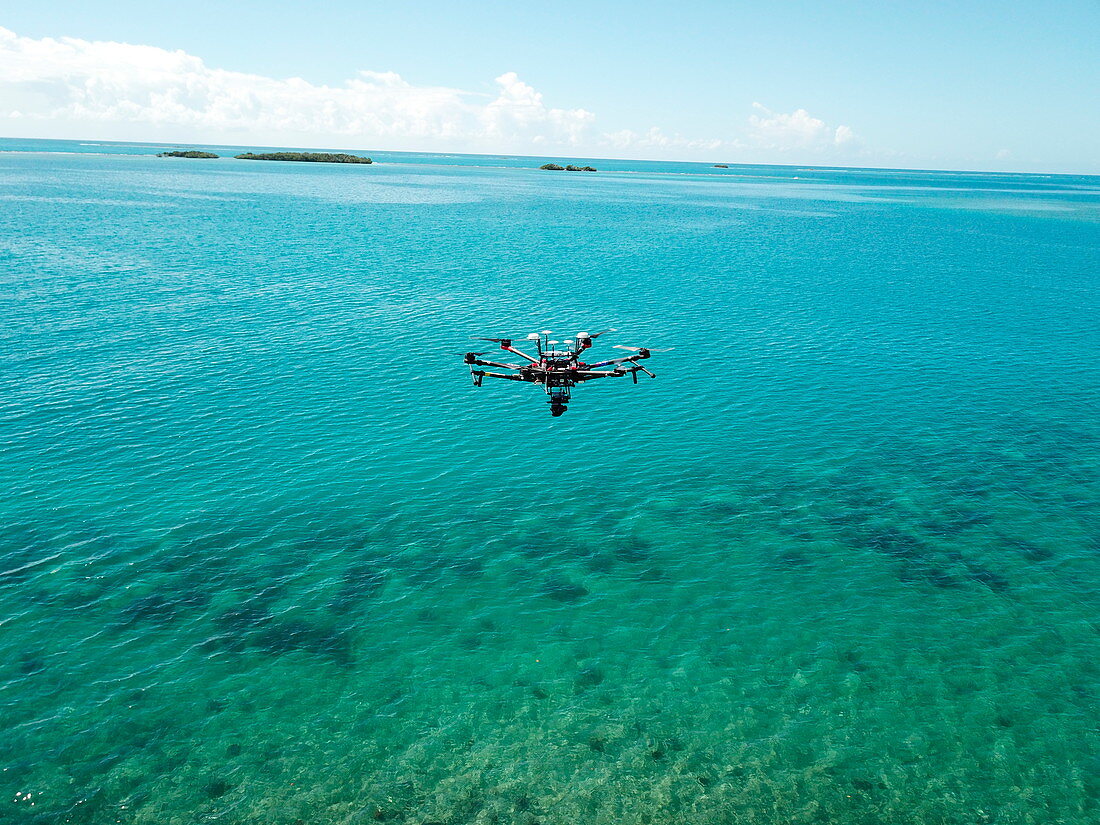
| Drone carrying a FluidCam instrument over the North Atlantic near Puerto Rico. FluidCam is a high-performance digital camera that can collect images while mounted on a drone flying above a body of water. Fluid lensing software processes the images taken by FluidCam and adjusts for the distortion created by the ocean surface. This technology, developed by NASA’s Ames Research Center, will be mounted on a small satellite and sent into orbit around the Earth to map ocean floors from space. | |
| Lizenzart: | Lizenzpflichtig |
| Credit: | Science Photo Library / NASA |
| Bildgröße: | 4827 px × 3620 px |
| Modell-Rechte: | nicht erforderlich |
| Eigentums-Rechte: | nicht erforderlich |
| Restrictions: | - |
Preise für dieses Bild ab 15 €
Universitäten & Organisationen
(Informationsmaterial Digital, Informationsmaterial Print, Lehrmaterial Digital etc.)
ab 15 €
Redaktionell
(Bücher, Bücher: Sach- und Fachliteratur, Digitale Medien (redaktionell) etc.)
ab 30 €
Werbung
(Anzeigen, Aussenwerbung, Digitale Medien, Fernsehwerbung, Karten, Werbemittel, Zeitschriften etc.)
ab 55 €
Handelsprodukte
(bedruckte Textilie, Kalender, Postkarte, Grußkarte, Verpackung etc.)
ab 75 €
Pauschalpreise
Rechtepakete für die unbeschränkte Bildnutzung in Print oder Online
ab 495 €