Iceberg calved from Pine Island Glacier, Antarctica
Bildnummer 13258754
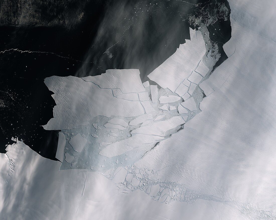
| Satellite image of a large glacier that shattered after calving from the Pine Island Glacier, Antarctica. The iceberg measured over 300 square kilometres. Pine Island Glacier is a type known as an ice stream, draining ice from the West Antarctic Ice Sheet into the ocean. If the glaciers in Antarctica disintegrate and melt, global sea levels would rise. Image obtained on 11th February 2020 by the Sentinel-2 satellite. | |
| Lizenzart: | Lizenzpflichtig |
| Credit: | Science Photo Library / EUROPEAN SPACE AGENCY / Copernicus Sentinel data (2020) |
| Bildgröße: | 5321 px × 4242 px |
| Modell-Rechte: | nicht erforderlich |
| Eigentums-Rechte: | nicht erforderlich |
| Restrictions: |
|
Preise für dieses Bild ab 15 €
Universitäten & Organisationen
(Informationsmaterial Digital, Informationsmaterial Print, Lehrmaterial Digital etc.)
ab 15 €
Redaktionell
(Bücher, Bücher: Sach- und Fachliteratur, Digitale Medien (redaktionell) etc.)
ab 30 €
Werbung
(Anzeigen, Aussenwerbung, Digitale Medien, Fernsehwerbung, Karten, Werbemittel, Zeitschriften etc.)
ab 55 €
Handelsprodukte
(bedruckte Textilie, Kalender, Postkarte, Grußkarte, Verpackung etc.)
ab 75 €
Pauschalpreise
Rechtepakete für die unbeschränkte Bildnutzung in Print oder Online
ab 495 €