Arctic sea ice opening, September 2019
Bildnummer 12991472
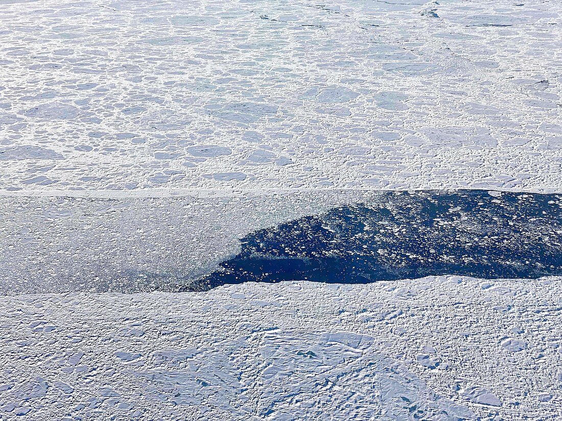
| Arctic sea ice opening, September 2019. This photo, taken during an Operation IceBridge flight, shows an opening in the sea ice cover north of Greenland. The opening (known as a 'lead') is partially filled by much smaller sea ice rubble and floes. Operation IceBridge is a NASA project that monitors polar ice cover using aircraft instead of satellites. It was introduced in 2009 as a replacement for the malfunctioning ICESat satellite. Photographed on 9 September 2019. | |
| Lizenzart: | Lizenzpflichtig |
| Credit: | Science Photo Library / NASA / Operation IceBridge |
| Bildgröße: | 3449 px × 2587 px |
| Modell-Rechte: | nicht erforderlich |
| Eigentums-Rechte: | nicht erforderlich |
| Restrictions: | - |
Preise für dieses Bild ab 15 €
Universitäten & Organisationen
(Informationsmaterial Digital, Informationsmaterial Print, Lehrmaterial Digital etc.)
ab 15 €
Redaktionell
(Bücher, Bücher: Sach- und Fachliteratur, Digitale Medien (redaktionell) etc.)
ab 30 €
Werbung
(Anzeigen, Aussenwerbung, Digitale Medien, Fernsehwerbung, Karten, Werbemittel, Zeitschriften etc.)
ab 55 €
Handelsprodukte
(bedruckte Textilie, Kalender, Postkarte, Grußkarte, Verpackung etc.)
ab 75 €
Pauschalpreise
Rechtepakete für die unbeschränkte Bildnutzung in Print oder Online
ab 495 €