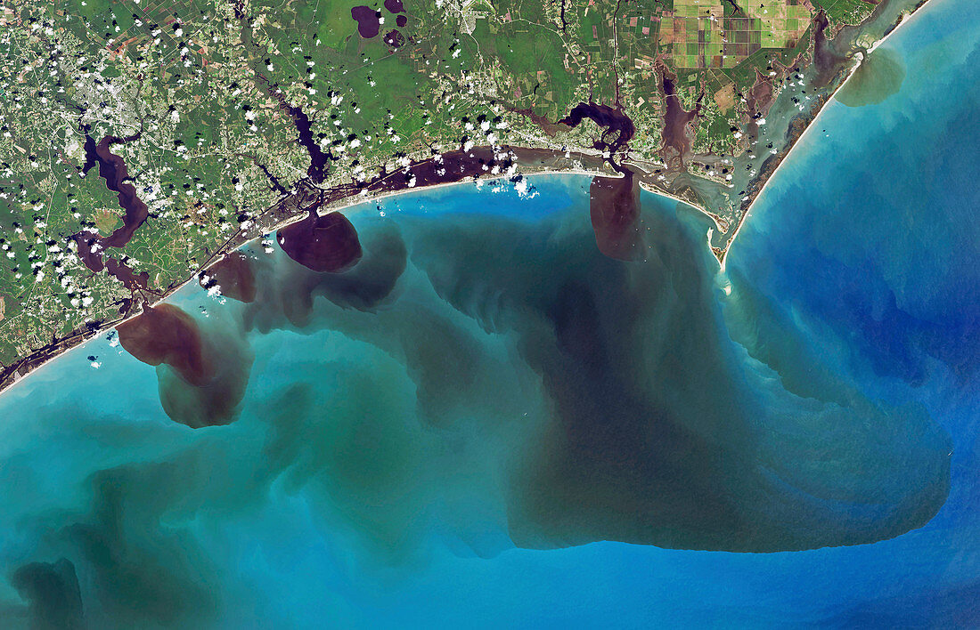
North Carolina flooding,September 2018,satellite image
Bildnummer 12961737

| North Carolina flooding,September 2018,satellite image. This flooding was caused by Hurricane Florence,which made landfall here on 14 September 2018,with 8 trillion gallons of rain falling on North Carolina over the course of 5 days. This image (around 120 kilometres across) shows the Atlantic coast near Cape Lookout (upper right),with outflows from (left to right): New River,White Oak River,and Adams Creek. This image uses visible light showing the natural colour of the region. Sediments,pollution and debris have discoloured the waters flowing from the swollen rivers. Image obtained on 19 September 2018,by the the Operational Land Imager (OLI) on the Landsat 8 satellite. For the infrared version of this image,showing levels of coloured dissolved organic matter (CDOM),see C048/2035. | |
| Lizenzart: | Lizenzpflichtig |
| Credit: | Science Photo Library / NASA / US Geological Survey Earth Observatory |
| Bildgröße: | 5213 px × 3353 px |
| Modell-Rechte: | nicht erforderlich |
| Eigentums-Rechte: | nicht erforderlich |
| Restrictions: | - |
Preise für dieses Bild ab 15 €
Universitäten & Organisationen
(Informationsmaterial Digital, Informationsmaterial Print, Lehrmaterial Digital etc.)
ab 15 €
Redaktionell
(Bücher, Bücher: Sach- und Fachliteratur, Digitale Medien (redaktionell) etc.)
ab 30 €
Werbung
(Anzeigen, Aussenwerbung, Digitale Medien, Fernsehwerbung, Karten, Werbemittel, Zeitschriften etc.)
ab 55 €
Handelsprodukte
(bedruckte Textilie, Kalender, Postkarte, Grußkarte, Verpackung etc.)
ab 75 €
Pauschalpreise
Rechtepakete für die unbeschränkte Bildnutzung in Print oder Online
ab 495 €
Keywords
- 2018,
- 21. Jahrhundert,
- Amerikanisch,
- Atlantikküste,
- extremes Wetter,
- geografisch,
- Küsten-,
- Landsat 8,
- menschliche Geografie,
- Meteorologie,
- meteorologisch,
- neuer Fluss,
- Niemand,
- Nordamerika,
- nordamerikanisch,
- North Carolina,
- oli,
- optisch,
- Satellit,
- Satellitenbild,
- Sediment,
- Sichtbar,
- Überschwemmung,
- Umwelt,
- uns,
- USA,
- Vereinigte Staaten,
- Verschmutzung,
- Weltall
