Mount Agung volcano in Indonesia, satellite image
Bildnummer 12950710
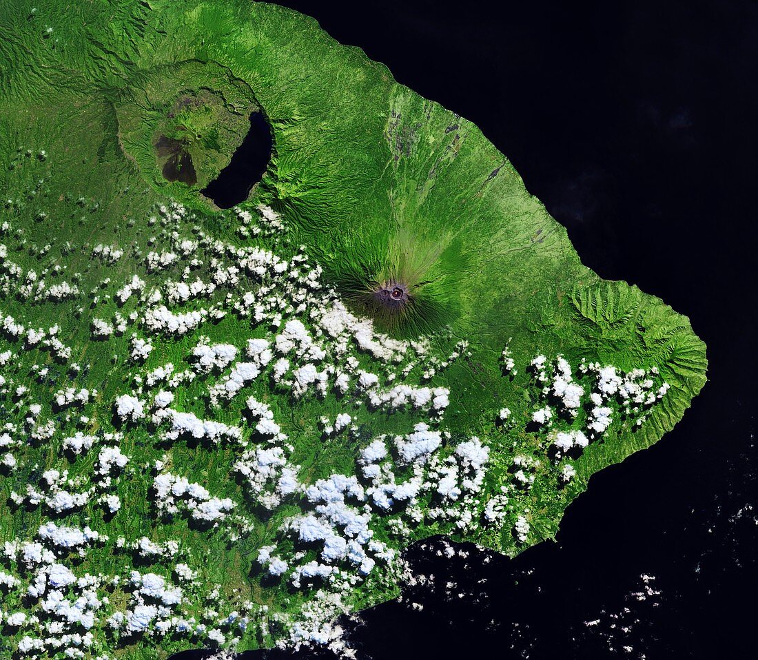
| Mount Agung volcano in Indonesia, satellite image. This volcano (summit at lower right) had been dormant for 50 years before erupting in November 2017. This activity is shown by the orange dot in the crater. The neighbouring Batur volcano is at upper left. Image data obtained on 2 July 2018, by the Copernicus Sentinel-2 satellites. | |
| Lizenzart: | Lizenzpflichtig |
| Credit: | Science Photo Library / Copernicus Sentinel data (2018) / EUROPEAN SPACE AGENCY |
| Bildgröße: | 5471 px × 4766 px |
| Modell-Rechte: | nicht erforderlich |
| Eigentums-Rechte: | nicht erforderlich |
| Restrictions: |
|
Preise für dieses Bild ab 15 €
Universitäten & Organisationen
(Informationsmaterial Digital, Informationsmaterial Print, Lehrmaterial Digital etc.)
ab 15 €
Redaktionell
(Bücher, Bücher: Sach- und Fachliteratur, Digitale Medien (redaktionell) etc.)
ab 30 €
Werbung
(Anzeigen, Aussenwerbung, Digitale Medien, Fernsehwerbung, Karten, Werbemittel, Zeitschriften etc.)
ab 55 €
Handelsprodukte
(bedruckte Textilie, Kalender, Postkarte, Grußkarte, Verpackung etc.)
ab 75 €
Pauschalpreise
Rechtepakete für die unbeschränkte Bildnutzung in Print oder Online
ab 495 €