Lena River Delta, satellite image
Bildnummer 12950708
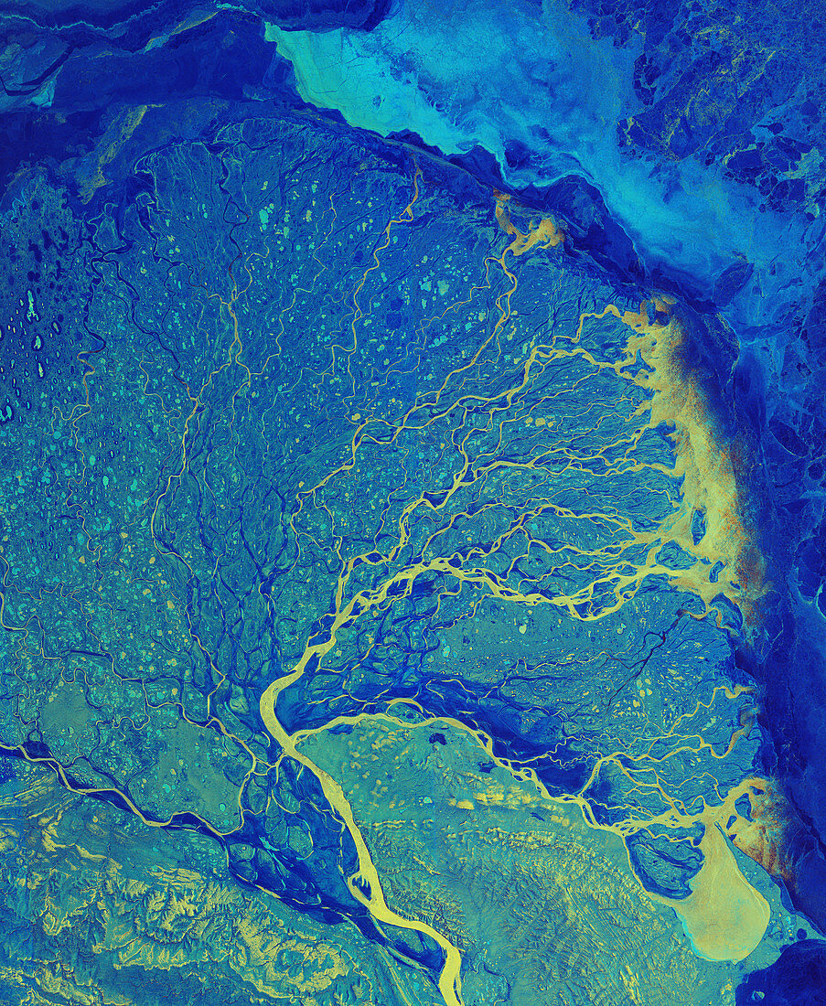
| Lena River Delta, satellite image, satellite image. The Lena River flows 4400 kilometres from south-central Russia, to this delta on the Arctic coast of north-west Russia. At the delta, the water spreads out through numerous channels, depositing its silt to build the land of the delta, before emptying into the Laptev Sea. The delta is frozen in the winter, but in summer it is a thriving wetland. Hundreds of small lakes and ponds are visible dotted around the tundra, with a large amount of ice present at the peak of the Arctic winter. Image data obtained on 14 January 2019, by the Copernicus Sentinel-1 satellites. | |
| Lizenzart: | Lizenzpflichtig |
| Credit: | Science Photo Library / Copernicus Sentinel data (2019) / EUROPEAN SPACE AGENCY |
| Bildgröße: | 5800 px × 7066 px |
| Modell-Rechte: | nicht erforderlich |
| Eigentums-Rechte: | nicht erforderlich |
| Restrictions: |
|
Preise für dieses Bild ab 15 €
Universitäten & Organisationen
(Informationsmaterial Digital, Informationsmaterial Print, Lehrmaterial Digital etc.)
ab 15 €
Redaktionell
(Bücher, Bücher: Sach- und Fachliteratur, Digitale Medien (redaktionell) etc.)
ab 30 €
Werbung
(Anzeigen, Aussenwerbung, Digitale Medien, Fernsehwerbung, Karten, Werbemittel, Zeitschriften etc.)
ab 55 €
Handelsprodukte
(bedruckte Textilie, Kalender, Postkarte, Grußkarte, Verpackung etc.)
ab 75 €
Pauschalpreise
Rechtepakete für die unbeschränkte Bildnutzung in Print oder Online
ab 495 €