Canaima National Park in Venezuala, LiDAR satellite image
Bildnummer 12950684
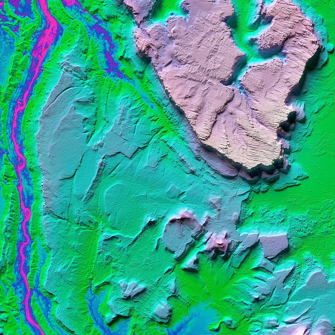
| Canaima National Park in Venezuala, LiDAR satellite image. This area of Venezuala is famous for its tepui, table-top mountains or mesas, rising vertically from the surrounding Guiana Highlands of South America. A tepui is at upper right (pink), with a river at left. LiDAR combines optical and laser imaging to produce digital elevation maps (DEMs), with differences in elevation shown by the colour-coding of the image. Image data obtained by the radar and optical sensors on the Advanced Land Observation Satellite (ALOS) of the Japan Aerospace Exploration Agency (JAXA). | |
| Lizenzart: | Lizenzpflichtig |
| Credit: | Science Photo Library / JAXA / MATTHEW HURST |
| Bildgröße: | 4180 px × 4180 px |
| Modell-Rechte: | nicht erforderlich |
| Eigentums-Rechte: | nicht erforderlich |
| Restrictions: | - |
Preise für dieses Bild ab 15 €
Universitäten & Organisationen
(Informationsmaterial Digital, Informationsmaterial Print, Lehrmaterial Digital etc.)
ab 15 €
Redaktionell
(Bücher, Bücher: Sach- und Fachliteratur, Digitale Medien (redaktionell) etc.)
ab 30 €
Werbung
(Anzeigen, Aussenwerbung, Digitale Medien, Fernsehwerbung, Karten, Werbemittel, Zeitschriften etc.)
ab 55 €
Handelsprodukte
(bedruckte Textilie, Kalender, Postkarte, Grußkarte, Verpackung etc.)
ab 75 €
Pauschalpreise
Rechtepakete für die unbeschränkte Bildnutzung in Print oder Online
ab 495 €