Global fire hot spots from 1996 to 2010, satellite map
Bildnummer 12949139
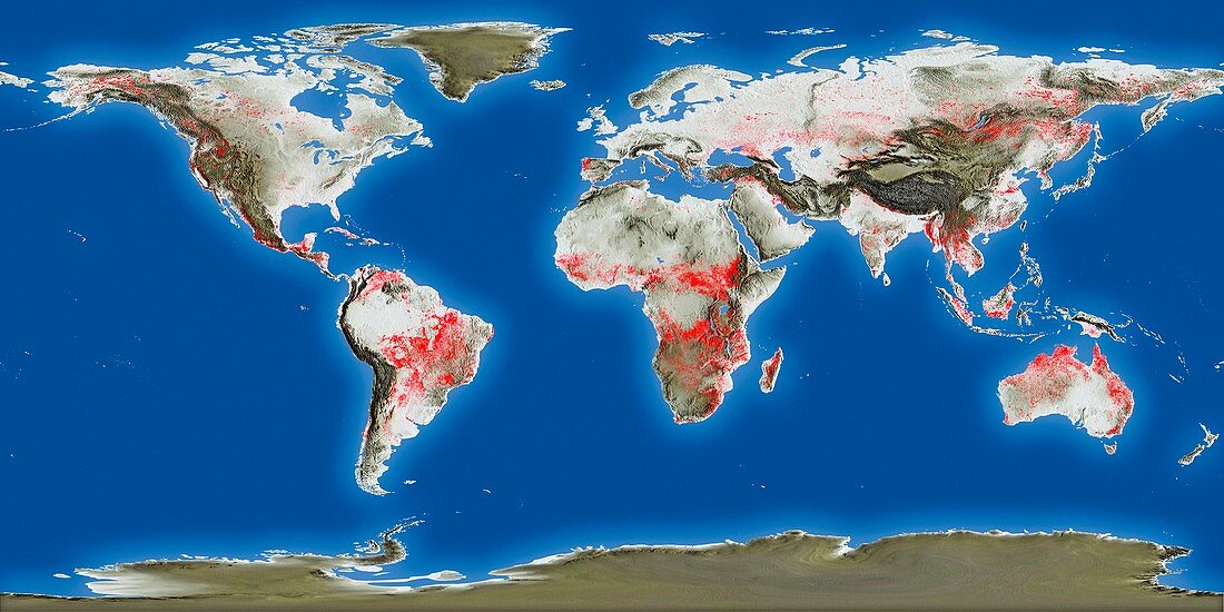
| Global fire hot spots from 1996 to 2010, satellite map. These hot spots (including wild fires) were detected by two ESA satellites: ERS-2's Along Track Scanning Radiometer (ATSR-2) and Envisat's Advanced Along Track Scanning Radiometer (AATSR). The date period covered was July 1996 to August 2010. These radiometers measure thermal infrared radiation to take the temperature of Earth's land surfaces. Temperatures exceeding 38.85 degrees Celsius are classified as a fire. | |
| Lizenzart: | Lizenzpflichtig |
| Credit: | Science Photo Library / ESA |
| Bildgröße: | 5000 px × 2500 px |
| Modell-Rechte: | nicht erforderlich |
| Eigentums-Rechte: | nicht erforderlich |
| Restrictions: |
|
Preise für dieses Bild ab 15 €
Universitäten & Organisationen
(Informationsmaterial Digital, Informationsmaterial Print, Lehrmaterial Digital etc.)
ab 15 €
Redaktionell
(Bücher, Bücher: Sach- und Fachliteratur, Digitale Medien (redaktionell) etc.)
ab 30 €
Werbung
(Anzeigen, Aussenwerbung, Digitale Medien, Fernsehwerbung, Karten, Werbemittel, Zeitschriften etc.)
ab 55 €
Handelsprodukte
(bedruckte Textilie, Kalender, Postkarte, Grußkarte, Verpackung etc.)
ab 75 €
Pauschalpreise
Rechtepakete für die unbeschränkte Bildnutzung in Print oder Online
ab 495 €