Grande America oil spill, satellite radar image
Bildnummer 12918034
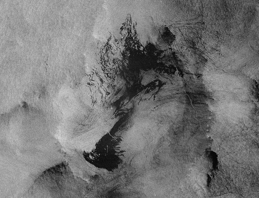
| Grande America oil spill, satellite radar image. The Italian container ship 'Grande America' was carrying over 2000 tonnes of heavy fuel when it caught fire and sank in the Atlantic on 12 March 2019 in the Bay of Biscay, around 300 kilometres off the coast of France. The sinking produced this oil spill (dark patch), around 50 kilometres long. The white dots in the oil spill are boats assisting in the clean-up operation. The oil spill is threatening the coastal areas around La Rochelle, Biarritz and Vendee in France. Radar image obtained on 19 March 2019 by the satellites of the ESA's Copernicus Sentinel-1 mission. | |
| Lizenzart: | Lizenzpflichtig |
| Credit: | Science Photo Library / Copernicus Sentinel data (2019) / EUROPEAN SPACE AGENCY |
| Bildgröße: | 6753 px × 5176 px |
| Modell-Rechte: | nicht erforderlich |
| Eigentums-Rechte: | nicht erforderlich |
| Restrictions: |
|
Preise für dieses Bild ab 15 €
Universitäten & Organisationen
(Informationsmaterial Digital, Informationsmaterial Print, Lehrmaterial Digital etc.)
ab 15 €
Redaktionell
(Bücher, Bücher: Sach- und Fachliteratur, Digitale Medien (redaktionell) etc.)
ab 30 €
Werbung
(Anzeigen, Aussenwerbung, Digitale Medien, Fernsehwerbung, Karten, Werbemittel, Zeitschriften etc.)
ab 55 €
Handelsprodukte
(bedruckte Textilie, Kalender, Postkarte, Grußkarte, Verpackung etc.)
ab 75 €
Pauschalpreise
Rechtepakete für die unbeschränkte Bildnutzung in Print oder Online
ab 495 €